Chelsea is a compact city in Suffolk County just across the Mystic River from Boston, set on a peninsula between the Mystic River and Chelsea Creek. Its rebuilt downtown along Broadway, its hilltop neighborhoods, and a Silver Line busway and commuter rail station connect it directly with Logan Airport, the Seaport, and downtown Boston.
Samuel Maverick settled the area, then called Winnisimmet, in the 1620s, and a ferry to Boston was running by the 1630s. It was part of Boston until 1739, when it was incorporated as a town and named for Chelsea, near London. A bridge to Charlestown opened in 1802 and a steam ferry followed in 1831. Chelsea became a city in 1857, and its 19th-century industries included leather, stoves and furnaces, paint, art tile, and the Chelsea Clock Works.
On April 12, 1908, a fire destroyed nearly half the city and left about 15,000 people homeless, and much of the burned area was rebuilt with multi-family housing. Chelsea borders Everett to the west and Revere to the north, with East Boston across Chelsea Creek and Charlestown across the Mystic River.
The Silver Line SL3 runs on dedicated bus lanes with four stops in Chelsea: Chelsea, Bellingham Square, Box District, and Eastern Avenue. From there it continues to Logan Airport, the Seaport, and South Station. Chelsea station is also a stop on the MBTA Newburyport/Rockport Line to North Station, and bus routes including the 111 to Haymarket and the 116 between Wonderland and Maverick cross the city. U.S. Route 1 crosses the Mystic River into Charlestown on the Tobin Bridge.
Chelsea real estate was shaped by the 1908 fire. Much of the burned district was rebuilt with triple-deckers and two-family houses, and four- and five-story brick apartment buildings stand south of the railroad tracks. Older blocks keep bowfront row houses near lower Broadway, mansard cottages, and double houses from the mid-1800s, along with Italianate, Second Empire, Queen Anne, and Colonial Revival homes.
On Admiral's Hill along the Mystic River, the buildings of the former U.S. Naval Hospital, which operated from 1836 to 1974, were converted to condominiums in the early 1980s, and the surrounding land was redeveloped with town houses and apartments. Neighborhoods include Admiral's Hill, Bellingham Square, Prattville, Mill Hill, Powder Horn Hill, and the Box District.
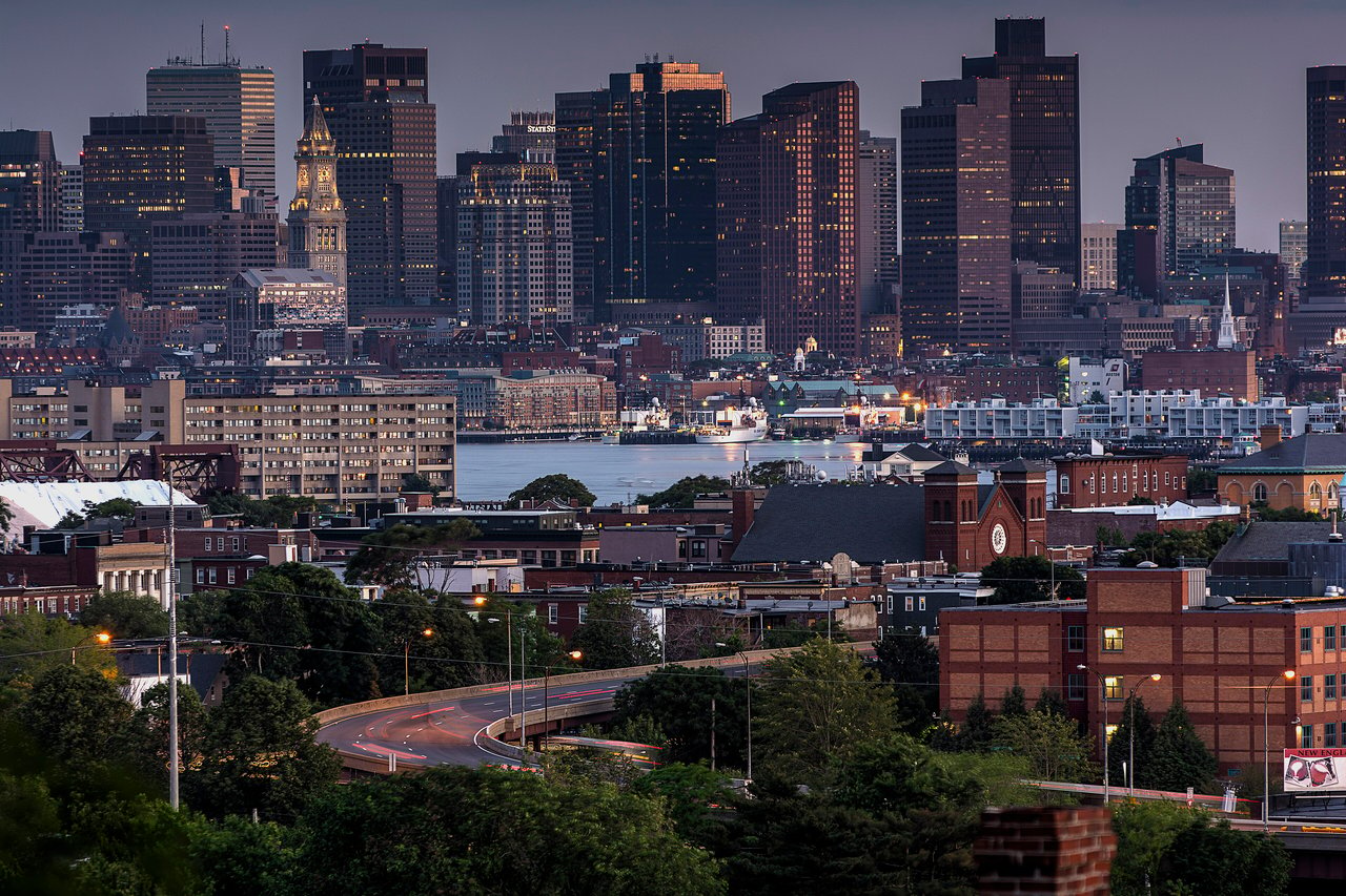
Mary O'Malley State Park, on Admiral's Hill overlooking the Mystic River, has paved paths for walking and running, a playground, tennis courts, open fields for picnics, and views of the Boston skyline and the Tobin Bridge. Powder Horn Hill, the highest of the city's four drumlins at about 230 feet, rises above the surrounding streets.
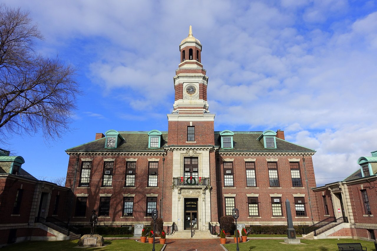
Broadway is Chelsea's main commercial street, and City Hall, completed in 1910, stands along it. Chelsea Creek marks the start of the Boston Harborwalk, a waterfront path that runs through Boston's harbor neighborhoods to the Neponset River. The Cary-Bellingham House, the city's finest surviving 18th-century house, recalls the farms that once covered the peninsula.
What kinds of homes are in Chelsea?
Chelsea has many triple-deckers and two-family houses built after the 1908 fire, along with brick apartment buildings, bowfront row houses, and mid-1800s cottages. On Admiral's Hill, former Naval Hospital buildings were converted to condominiums, alongside town houses and apartments.
How do you get to Boston from Chelsea?
The Silver Line SL3 runs from four Chelsea stops to Logan Airport, the Seaport, and South Station. Chelsea station on the Newburyport/Rockport Line goes to North Station, MBTA buses run to Haymarket, and the Tobin Bridge carries U.S. Route 1 into Charlestown.
What happened in the Chelsea fire of 1908?
On April 12, 1908, a fire destroyed nearly half of Chelsea and left about 15,000 people homeless. Much of the burned area, including the old town center, was rebuilt with triple-deckers, two-family houses, and brick apartment buildings.
To see homes for sale in Chelsea, browse the listings below. Thinking of buying or selling in Chelsea? Call (617) 848-9616 or get a free home valuation. Chelsea is part of our North of Boston guide.
Photos: Daderot (CC0) and Bill Damon, CC BY 2.0, via Wikimedia Commons.
39,908 people live in Chelsea, where the median age is 34.4 and the average individual income is $32,986. Data provided by the U.S. Census Bureau.
Total Population
Median Age
Population Density Population Density This is the number of people per square mile in a neighborhood.
Average individual Income
There's plenty to do around Chelsea, including shopping, dining, nightlife, parks, and more. Data provided by Walk Score and Yelp.
Explore popular things to do in the area, including Johnny's Market 3, Latinos Market, and Sweet Things.
| Name | Category | Distance | Reviews |
Ratings by
Yelp
|
|---|---|---|---|---|
| Dining | 0.13 miles | 1 review | 1/5 stars | |
| Dining | 0.25 miles | 0 reviews | 0/5 stars | |
| Dining | 0.25 miles | 0 reviews | 0/5 stars | |
| Dining | 0.4 miles | 0 reviews | 0/5 stars | |
| Dining | 0.49 miles | 0 reviews | 0/5 stars | |
| Dining | 0.56 miles | 0 reviews | 0/5 stars | |
| Dining | 0.58 miles | 0 reviews | 0/5 stars | |
| Dining | 0.6 miles | 0 reviews | 0/5 stars | |
| Dining | 0.62 miles | 0 reviews | 0/5 stars | |
| Dining | 0.63 miles | 0 reviews | 0/5 stars | |
| Dining | 0.67 miles | 0 reviews | 0/5 stars | |
| Shopping | 0.48 miles | 0 reviews | 0/5 stars | |
| Active | 0.33 miles | 0 reviews | 0/5 stars | |
| Active | 0.33 miles | 0 reviews | 0/5 stars | |
| Active | 0.33 miles | 0 reviews | 0/5 stars | |
| Active | 0.38 miles | 0 reviews | 0/5 stars | |
| Active | 0.41 miles | 0 reviews | 0/5 stars | |
| Active | 0.51 miles | 0 reviews | 0/5 stars | |
| Active | 0.76 miles | 0 reviews | 0/5 stars | |
| Nightlife | 0.62 miles | 0 reviews | 0/5 stars | |
| Beauty | 0.04 miles | 0 reviews | 0/5 stars | |
| Beauty | 0.32 miles | 0 reviews | 0/5 stars | |
| Beauty | 0.52 miles | 1 review | 5/5 stars | |
|
|
||||
|
|
||||
|
|
||||
|
|
||||
|
|
||||
|
|
Chelsea has 13,716 households, with an average household size of 2.85. Data provided by the U.S. Census Bureau. Here’s what the people living in Chelsea do for work — and how long it takes them to get there. Data provided by the U.S. Census Bureau. 39,908 people call Chelsea home. The population density is 17,987 and the largest age group is Data provided by the U.S. Census Bureau.
Total Population
Population Density Population Density This is the number of people per square mile in a neighborhood.
Median Age
Men vs Women
Population by Age Group
0-9 Years
10-17 Years
18-24 Years
25-64 Years
65-74 Years
75+ Years
Education Level
Total Households
Average Household Size
Average individual Income
Households with Children
With Children:
Without Children:
Marital Status
Blue vs White Collar Workers
Blue Collar:
White Collar: