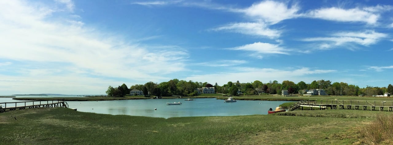
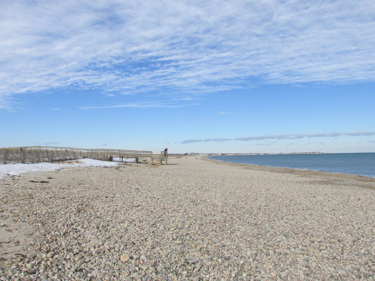
Duxbury is a coastal town in Plymouth County about 30 miles southeast of Boston, on Duxbury Bay and Cape Cod Bay. It pairs Duxbury Beach, a barrier beach reached by the Powder Point Bridge, with Federal-era houses along Washington Street, the Hall's Corner shopping area in South Duxbury, Powder Point and Snug Harbor on the bay, Pilgrim-era historic sites, and two Route 3 exits.
Native people lived and fished along this coast long before English settlement. After Plymouth Colony divided its coastal land in 1627, colonists including Myles Standish and John Alden moved to farms here, and the town's church was gathered in 1632. Duxbury was incorporated in 1637, likely named by Standish for his family's English home, and it originally included what is now Pembroke.
Shipbuilding grew through the 1700s and peaked in the early 1800s, when yards lined the bay and Ezra Weston's family firm, known for "King Caesar," ran one of the South Shore's largest shipping businesses from Powder Point. The bay proved too shallow for larger ships, and the trade faded after about 1840. On July 23, 1869, the French Atlantic cable came ashore on Duxbury Beach, linking the town by telegraph to France. The railroad reached South Duxbury in 1871, summer visitors followed, and Route 3 brought year-round growth in the 1960s. Duxbury borders Marshfield to the north, Pembroke to the west, and Kingston to the southwest, with Duxbury Bay and Cape Cod Bay to the east and a small land border with Plymouth at the end of Duxbury Beach.
Duxbury has no train station or MBTA bus service. Kingston station on the MBTA Kingston Line, built as a Route 3 park-and-ride, is a short drive away, with trains to South Station, and GATRA buses connect Hall's Corner and the library with Kingston station on weekdays. Route 3, the Pilgrims Highway, has two exits in Duxbury, at Route 3A and Route 53 and at Route 14, and leads north through Norwell toward Boston. Route 3A, Tremont Street, runs north and south through town, and the Powder Point Bridge, a half-mile wooden bridge, is the only road from Duxbury to Duxbury Beach.
Duxbury real estate ranges from colonial Capes to sea captains' houses, summer cottages, and postwar homes. Center-chimney and hip-roofed Federal houses line Washington Street, smaller cottages from the same era stand inland at Tinkertown and Ashdod, and Greek Revival civic buildings cluster on Tremont Street. Queen Anne, Shingle Style, and Colonial Revival summer houses went up at South Duxbury and Powder Point in the late 1800s, Craftsman cottages and bungalows followed along the shore, and many single-family neighborhoods were built after Route 3 opened.
The Old Shipbuilder's Historic District along Washington Street, listed on the National Register in 1986, covers the sea captains' and shipwrights' houses from Hall's Corner to Powder Point, and the Cove Street and Old Town Hall districts were listed in 2019 and 2021. Duxbury also has local historic districts reviewed by a town commission. The town has its own water system supplied by wells, and many homes use septic systems. Areas include Duxbury Village, Powder Point, Snug Harbor, South Duxbury and Hall's Corner, Island Creek, Millbrook, Tinkertown, and Ashdod.
Duxbury Beach runs about six miles between Cape Cod Bay and Duxbury Bay and has been owned since the mid-1970s by the nonprofit Duxbury Beach Reservation, which leases part of it to the town. Resident stickers cover the lots over the Powder Point Bridge, while nonresidents can buy oversand permits or use day parking at Duxbury Beach Park by way of Marshfield, and sections close in summer for nesting piping plovers and terns. Duxbury Bay is known for oyster farming, including Island Creek Oysters, and Mass Audubon's North Hill Marsh sanctuary has trails around a large pond.
The Duxbury Rural and Historical Society runs the 1809 King Caesar House on Powder Point, the Capt. Gershom Bradford House, and the Drew Archival Library. The Alden House Historic Site on Alden Street is part of a National Historic Landmark, the Myles Standish Monument rises on Captain's Hill, and the Art Complex Museum on Alden Street shows the Weyerhaeuser family collection with free admission. The Duxbury Free Library sits near the Alden House, and the Fourth of July parade runs from Hall's Corner each summer.
How do you get to Boston from Duxbury?
Duxbury has no train station, but Kingston station on the MBTA Kingston Line is a short drive away, with trains to South Station. By car, Route 3 has two exits in Duxbury and runs north toward Boston.
Who can park at Duxbury Beach?
Resident beach stickers cover the lots over the Powder Point Bridge. Nonresidents can buy oversand permits or use day parking at Duxbury Beach Park, reached through Marshfield. Rules change each season, so check the town's current beach information.
What is the Old Shipbuilder's Historic District?
It is a National Register historic district along Washington Street, from Hall's Corner to Powder Point, where shipbuilders, sea captains, and merchants built houses in the late 1700s and early 1800s.
To see homes for sale in Duxbury, browse the listings below. Thinking of buying or selling in Duxbury? Call (617) 848-9616 or get a free home valuation. Duxbury is part of our South Shore guide.
Photos: Historical Perspective 2, CC BY-SA 4.0 and John Phelan, CC BY-SA 3.0, via Wikimedia Commons.
16,185 people live in Duxbury, where the median age is 47.6 and the average individual income is $89,145. Data provided by the U.S. Census Bureau.
Total Population
Median Age
Population Density Population Density This is the number of people per square mile in a neighborhood.
Average individual Income
There's plenty to do around Duxbury, including shopping, dining, nightlife, parks, and more. Data provided by Walk Score and Yelp.
Explore popular things to do in the area, including Humble Taco Food Truck, The Anchor, and Fire & Stone Trattoria and Pizza Bar.
| Name | Category | Distance | Reviews |
Ratings by
Yelp
|
|---|---|---|---|---|
| Dining | 0.27 miles | 1 review | 5/5 stars | |
| Dining | 1.2 miles | 58 reviews | 4.2/5 stars | |
| Dining · $$ | 1.21 miles | 98 reviews | 4.5/5 stars | |
| Dining | 1.43 miles | 19 reviews | 4.9/5 stars | |
| Dining · $ | 1.43 miles | 16 reviews | 4.5/5 stars | |
| Dining | 1.47 miles | 0 reviews | 0/5 stars | |
| Dining · $$ | 1.75 miles | 114 reviews | 4.1/5 stars | |
| Dining | 1.87 miles | 0 reviews | 0/5 stars | |
| Dining | 1.87 miles | 9 reviews | 4.9/5 stars | |
| Dining · $$$ | 1.9 miles | 210 reviews | 3.8/5 stars | |
| Dining | 1.91 miles | 0 reviews | 0/5 stars | |
| Dining · $$ | 1.92 miles | 65 reviews | 3.9/5 stars | |
| Active | 0.27 miles | 0 reviews | 0/5 stars | |
| Active | 0.35 miles | 0 reviews | 0/5 stars | |
| Active | 0.76 miles | 0 reviews | 0/5 stars | |
| Active | 1.2 miles | 0 reviews | 0/5 stars | |
| Active | 1.47 miles | 0 reviews | 0/5 stars | |
| Active | 1.5 miles | 0 reviews | 0/5 stars | |
| Active | 1.71 miles | 0 reviews | 0/5 stars | |
| Nightlife | 0.37 miles | 0 reviews | 0/5 stars | |
| Nightlife | 1.8 miles | 1 review | 4/5 stars | |
| Beauty | 1.39 miles | 0 reviews | 0/5 stars | |
| Beauty | 1.5 miles | 2 reviews | 5/5 stars | |
| Beauty | 1.89 miles | 29 reviews | 3.7/5 stars | |
|
|
||||
|
|
||||
|
|
||||
|
|
||||
|
|
||||
|
|
Duxbury has 6,130 households, with an average household size of 2.62. Data provided by the U.S. Census Bureau. Here’s what the people living in Duxbury do for work — and how long it takes them to get there. Data provided by the U.S. Census Bureau. 16,185 people call Duxbury home. The population density is 683 and the largest age group is Data provided by the U.S. Census Bureau.
Total Population
Population Density Population Density This is the number of people per square mile in a neighborhood.
Median Age
Men vs Women
Population by Age Group
0-9 Years
10-17 Years
18-24 Years
25-64 Years
65-74 Years
75+ Years
Education Level
Total Households
Average Household Size
Average individual Income
Households with Children
With Children:
Without Children:
Marital Status
Blue vs White Collar Workers
Blue Collar:
White Collar: