Milton is a town directly south of Boston, set between the Neponset River and the Blue Hills. Great Blue Hill, the tallest summit in the Blue Hills Reservation, rises at the town's southern edge, and much of Milton is residential, with single-family homes on tree-lined streets, historic estates on Milton Hill and Brush Hill, and village centers at Milton Village, East Milton, and Milton Centre.
Milton was first settled in 1640 as a village of Dorchester called Unquity, from a Native name for the place where the Neponset River meets the tidewater. It separated from Dorchester and was incorporated as a town in 1662. Mills grew up at the falls of the Neponset, making paper, gunpowder, and iron, and in 1764 the Walter Baker Chocolate Company began there, operating in Milton and Dorchester for about two centuries. In September 1774, delegates from Suffolk County met in Milton and adopted the Suffolk Resolves, often called an early declaration of independence.
In 1826 the Granite Railway carried stone from Quincy through East Milton to the Neponset for shipment to Charlestown, and East Milton was long known as Railway Village. In the late 1800s, Boston merchants built country estates along Adams Street, Canton Avenue, and Brush Hill Road, many designed by Boston architects such as William Ralph Emerson. Milton borders Dorchester and Mattapan to the north, Hyde Park to the west, Quincy to the east, and Randolph and Canton to the south and west.
The Mattapan trolley, an extension of the Red Line, follows the Neponset with stops at Milton, Central Avenue, Valley Road, and Capen Street, connecting to the Red Line at Ashmont in Dorchester. Interstate 93 loops around the town's southern and eastern edges, and Routes 28 and 138 run north and south through town.
Milton's housing is mostly single-family, and its range of eras is wide. The oldest homes are 18th-century center-chimney and center-hall houses and Federal-era houses near the old village centers and Milton Hill, joined by modest Greek Revival cottages from the early 1800s. The country estates of the late 1800s, in Queen Anne, Shingle Style, and Colonial Revival designs, stand on large lots on Milton Hill, on Brush Hill, and along Canton Avenue.
The early 20th century filled in neighborhoods closer to the Neponset and the trolley line with Colonial Revival and Craftsman single-family houses and some two-family homes, and later decades added mid-century houses on the streets near the Blue Hills.
The Blue Hills Reservation, about 7,000 acres of state parkland established in 1893, covers roughly a fifth of Milton's land, with trails to the summit of Great Blue Hill, where the Blue Hill Observatory has recorded the weather since 1885. The Captain Robert Bennet Forbes House Museum, a Greek Revival mansion on Milton Hill listed on the National Register of Historic Places, and the Suffolk Resolves House on Canton Avenue, home of the Milton Historical Society, keep the town's history in view.
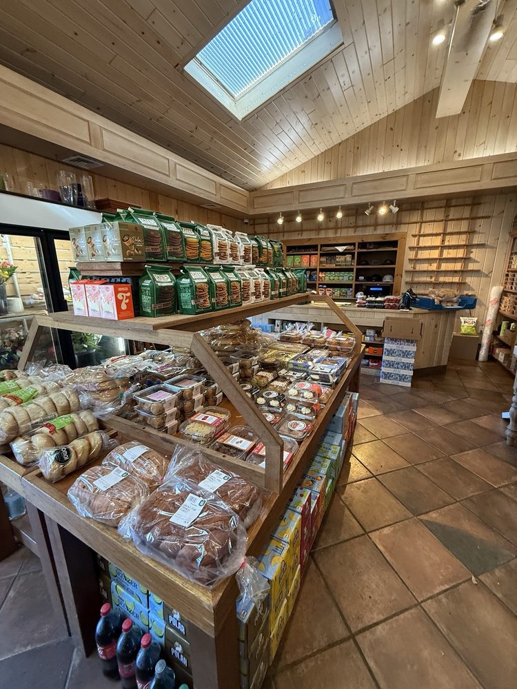
Shops and restaurants cluster in Milton Village at the Lower Mills, in East Milton Square, and around Milton Centre, and the Neponset River runs along the town's northern edge.
What kinds of homes are in Milton?
Milton's housing is mostly single-family, from 18th-century center-chimney and Federal-era houses near the old village centers to late 1800s country estates on Milton Hill, Brush Hill and Canton Avenue. Colonial Revival and Craftsman houses and some two-family homes fill neighborhoods near the Neponset and the trolley line.
How do you get to Boston from Milton?
The Mattapan trolley, an extension of the Red Line, stops at Milton, Central Avenue, Valley Road and Capen Street and connects to the Red Line at Ashmont in Dorchester. Interstate 93 loops around the town's southern and eastern edges, and Routes 28 and 138 run north and south through town.
How much of Milton is in the Blue Hills Reservation?
The Blue Hills Reservation, about 7,000 acres of state parkland established in 1893, covers roughly a fifth of Milton's land. Trails lead to the summit of Great Blue Hill, where the Blue Hill Observatory has recorded the weather since 1885.
To see homes for sale in Milton, browse the listings below. Thinking of buying or selling in Milton? Call (617) 848-9616 or get a free home valuation. Milton is part of our South Shore guide.
28,735 people live in Milton, where the median age is 41 and the average individual income is $74,509. Data provided by the U.S. Census Bureau.
Total Population
Median Age
Population Density Population Density This is the number of people per square mile in a neighborhood.
Average individual Income
There's plenty to do around Milton, including shopping, dining, nightlife, parks, and more. Data provided by Walk Score and Yelp.
Explore popular things to do in the area, including Concoctions, Eagle Farms, and Metrakas Deli.
| Name | Category | Distance | Reviews |
Ratings by
Yelp
|
|---|---|---|---|---|
| Dining | 0 miles | 0 reviews | 0/5 stars | |
| Dining · $$ | 1.07 miles | 32 reviews | 4/5 stars | |
| Dining | 1.53 miles | 3 reviews | 5/5 stars | |
| Shopping | 0.6 miles | 0 reviews | 0/5 stars | |
| Active | 0.56 miles | 0 reviews | 0/5 stars | |
| Active | 0.79 miles | 1 review | 1/5 stars | |
| Active | 2.11 miles | 0 reviews | 0/5 stars | |
| Active | 2.11 miles | 0 reviews | 0/5 stars | |
| Active | 2.16 miles | 0 reviews | 0/5 stars | |
| Active | 2.16 miles | 0 reviews | 0/5 stars | |
| Beauty | 2.15 miles | 12 reviews | 4.1/5 stars | |
|
|
||||
|
|
||||
|
|
||||
|
|
||||
|
|
||||
|
|
Milton has 9,121 households, with an average household size of 2.97. Data provided by the U.S. Census Bureau. Here’s what the people living in Milton do for work — and how long it takes them to get there. Data provided by the U.S. Census Bureau. 28,735 people call Milton home. The population density is 2,098 and the largest age group is Data provided by the U.S. Census Bureau.
Total Population
Population Density Population Density This is the number of people per square mile in a neighborhood.
Median Age
Men vs Women
Population by Age Group
0-9 Years
10-17 Years
18-24 Years
25-64 Years
65-74 Years
75+ Years
Education Level
Total Households
Average Household Size
Average individual Income
Households with Children
With Children:
Without Children:
Marital Status
Blue vs White Collar Workers
Blue Collar:
White Collar: