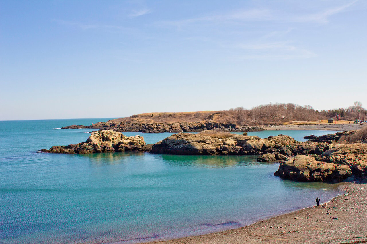
Nahant is a town in Essex County about 14 miles from Boston by road, set on a rocky near-island joined to Lynn by a sandy causeway. It is the smallest municipality in Massachusetts by land area, with ocean on nearly every side, beaches, hilltop parks, and streets of 19th-century summer houses.
For two centuries Nahant was part of Lynn and served mostly as common pasture, and only three houses stood here around 1800. That changed quickly: a hotel was operating by the early 1800s, steamboats began running from Boston in 1817, and the Nahant Hotel opened at East Point in 1823. Beginning in 1824 Cornelius Coolidge laid out a summer colony along Cliff Street and Swallow Cave Road, and by the 1840s Nahant was known as a summer resort for Boston's elite. Nahant separated from Lynn and became a town in 1853.
Frederic Tudor, the Boston merchant known as the Ice King, built a house here in the 1820s, and the Lodge family summered on Cliff Street, where the Henry Cabot Lodge House is on the National Register of Historic Places. The Army built Fort Ruckman in the early 1900s, and East Point held World War II coastal batteries and later a Nike missile site. Nahant's only land border is with Lynn, at the end of the causeway, and the town is otherwise surrounded by Nahant Bay, Nahant Harbor, Lynn Harbor, and Broad Sound.
Nahant Road is the town's main road, running from the Nahant Rotary in Lynn across the causeway and through town. MBTA bus route 439 connects Nahant with Lynn and Wonderland station on the Blue Line. The nearest commuter rail stop is in Lynn, on the MBTA Newburyport/Rockport Line, with service to North Station, and a seasonal ferry runs from Lynn's Blossom Street Pier to Long Wharf in Boston.
Nahant real estate grew out of its resort years. The oldest surviving houses are summer homes built by wealthy Bostonians in the 1820s and 1830s, including Frederic Tudor's house and Samuel Eliot's Greek Revival house with a Doric portico. The Cliff Street and Swallow Cave Road summer colony has houses from the 1820s through the 1880s, including mansard-roofed and Colonial Revival homes.
By the late 1800s larger houses on big lots took the scenic eastern side of town, with smaller cottages filling in between. Bass Point, once a day-trip resort with dance halls and an amusement park, filled in with homes after a 1925 fire. Today Nahant is almost entirely residential. Areas include Little Nahant, Bass Point, East Point, Bailey's Hill, Black Rock Point, and the Cliff Street area.
Nahant Beach Reservation, a state park run by the Department of Conservation and Recreation, includes Long Beach, more than a mile of sand along the causeway, plus a boat ramp to Lynn Harbor and athletic fields near the rotary. Short Beach is also on the causeway, next to Little Nahant. The town's 1.4-mile Heritage Trail runs from Short Beach to Bailey's Hill, passing the Nahant Life-Saving Station, a building from around 1900 that is now on the National Register, and the old Fort Ruckman grounds.
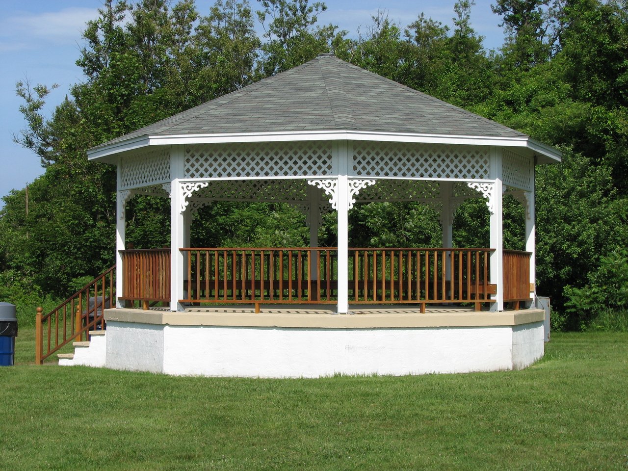
At East Point, Lodge Park has ocean-view trails and views of the Boston skyline, next to Northeastern University's Marine Science Center. Bailey's Hill Park has a hilltop gazebo, and Marjoram Hill Park sits next to Nahant Wharf. Town Hall, from 1912, and the 1895 public library form the Nahant Civic Historic District on Nahant Road.
What kinds of homes are in Nahant?
Nahant has summer houses from the 1820s and 1830s, homes along the Cliff Street and Swallow Cave Road summer colony, and larger houses on the scenic eastern side of town. Cottages, homes at Bass Point and Little Nahant, and ocean-view houses throughout add variety.
How do you get to Boston from Nahant?
MBTA bus route 439 connects Nahant with Lynn and with Wonderland station on the Blue Line. Commuter rail trains to North Station leave from Lynn, and a seasonal ferry runs from Lynn to Long Wharf in Boston.
Is Nahant an island?
Nahant is a tied island, connected to Lynn by a sandy causeway that carries Nahant Road and Long Beach. The town has two parts, Little Nahant near the causeway and the larger main section to the south.
To see homes for sale in Nahant, browse the listings below. Thinking of buying or selling in Nahant? Call (617) 848-9616 or get a free home valuation. Nahant is part of our North of Boston guide.
Photos: Pilgrimsong, CC BY-SA 3.0 and JPizzle1122, public domain, via Wikimedia Commons.
3,325 people live in Nahant, where the median age is 60.7 and the average individual income is $97,976. Data provided by the U.S. Census Bureau.
Total Population
Median Age
Population Density Population Density This is the number of people per square mile in a neighborhood.
Average individual Income
There's plenty to do around Nahant, including shopping, dining, nightlife, parks, and more. Data provided by Walk Score and Yelp.
Explore popular things to do in the area, including Nahant Convenience Store, ZOOGUU, and JEarleysHair.
| Name | Category | Distance | Reviews |
Ratings by
Yelp
|
|---|---|---|---|---|
| Dining | 0.62 miles | 0 reviews | 0/5 stars | |
| Shopping | 0.23 miles | 0 reviews | 0/5 stars | |
| Beauty | 0.24 miles | 0 reviews | 0/5 stars | |
|
|
||||
|
|
||||
|
|
||||
|
|
||||
|
|
||||
|
|
Nahant has 1,589 households, with an average household size of 2.06. Data provided by the U.S. Census Bureau. Here’s what the people living in Nahant do for work — and how long it takes them to get there. Data provided by the U.S. Census Bureau. 3,325 people call Nahant home. The population density is 3,091 and the largest age group is Data provided by the U.S. Census Bureau.
Total Population
Population Density Population Density This is the number of people per square mile in a neighborhood.
Median Age
Men vs Women
Population by Age Group
0-9 Years
10-17 Years
18-24 Years
25-64 Years
65-74 Years
75+ Years
Education Level
Total Households
Average Household Size
Average individual Income
Households with Children
With Children:
Without Children:
Marital Status
Blue vs White Collar Workers
Blue Collar:
White Collar: