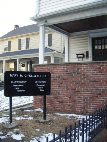
Arlington is a town in Middlesex County, about six miles northwest of Boston, that sits between Cambridge and Lexington along Massachusetts Avenue. It was first settled as the village of Menotomy, and today it is a town of homes with level streets in the east, hills in the west, Spy Pond near its center, and the Minuteman Bikeway running through it.
Arlington was settled in 1635 as Menotomy, part of Cambridge, and its first mill was built on Mill Brook two years later. On April 19, 1775, British troops retreating from Lexington and Concord fought their way through the village along what is now Massachusetts Avenue, and the fighting at the Jason Russell House was the bloodiest of that first day of the American Revolution. The house is now a museum run by the Arlington Historical Society.
The town was set off from Cambridge in 1807 as West Cambridge and renamed Arlington in 1867 to honor those buried at Arlington National Cemetery. Mills lined Mill Brook, and ice cut from Spy Pond was shipped as far as India. Samuel Wilson, the meat packer who became known as Uncle Sam, was born here, and a statue in Arlington Center marks it. Arlington borders Winchester to the north, Medford and Somerville to the east, Cambridge and Belmont to the south, and Lexington to the west.
Arlington has no subway station of its own, but Alewife station on the Red Line sits just over the line in Cambridge and is reachable by the Minuteman Bikeway and by bus. MBTA route 77 runs the length of Massachusetts Avenue from Arlington Heights to Harvard, and other routes connect Arlington Center with Sullivan Square and Alewife. Route 2 crosses the southern part of town, and Routes 3 and 60 meet in Arlington Center.
Arlington real estate is mostly older homes. Single-family Colonials, Queen Anne and other Victorian houses, and two-family houses make up much of the stock, and much of the town's housing was built before World War II. Condominiums and townhouses offer smaller options, many in converted two-family houses or near the commercial centers. Neighborhoods with their own character include East Arlington, Arlington Center, Arlington Heights, Morningside, and Jason Heights. Arlington Heights, once known as Peirce's Hill, was opened for house lots in the 1870s and has long been known for its views toward Boston.
Arlington protects its older streets through seven local historic districts, including Avon Place, Broadway, Central Street, Jason/Gray, Mount Gilboa/Crescent Hill, Pleasant Street, and Russell, which together include more than 300 properties.
The Minuteman Bikeway, a 10-mile paved rail trail, runs from Alewife through Arlington Center to Lexington and Bedford, roughly following Paul Revere's route. Spy Pond Park offers walks along the shore and paddling on the pond, and Robbins Farm Park on Eastern Avenue looks out over the Boston skyline from a hilltop. Menotomy Rocks Park in the Heights keeps a wooded, rocky landscape shaped by glaciers.
Massachusetts Avenue is the main street, with shops and restaurants in East Arlington, Arlington Center, and Arlington Heights. East Arlington is home to the 1920s Capitol Theatre, and Arlington Center has the Robbins Library, Town Hall, and the Cyrus Dallin Art Museum in the historic Jefferson Cutter House.
To see homes for sale in Arlington, browse the listings below or contact Berkshire Hathaway HomeServices Warren Residential.
46,015 people live in Arlington, where the median age is 41.3 and the average individual income is $83,001. Data provided by the U.S. Census Bureau.
Total Population
Median Age
Population Density Population Density This is the number of people per square mile in a neighborhood.
Average individual Income
There's plenty to do around Arlington, including shopping, dining, nightlife, parks, and more. Data provided by Walk Score and Yelp.
Explore popular things to do in the area, including Peter Pan Superette, Moore Bakery Distributor, and Wild Ember.
| Name | Category | Distance | Reviews |
Ratings by
Yelp
|
|---|---|---|---|---|
| Dining · $$$ | 1.04 miles | 2 reviews | 2/5 stars | |
| Dining | 1.49 miles | 0 reviews | 0/5 stars | |
| Active | 0.23 miles | 0 reviews | 0/5 stars | |
| Active | 0.39 miles | 0 reviews | 0/5 stars | |
| Active | 0.41 miles | 0 reviews | 0/5 stars | |
| Active | 0.41 miles | 0 reviews | 0/5 stars | |
| Active | 0.58 miles | 0 reviews | 0/5 stars | |
| Active | 0.6 miles | 0 reviews | 0/5 stars | |
| Active | 1.23 miles | 0 reviews | 0/5 stars | |
| Beauty | 0.39 miles | 0 reviews | 0/5 stars | |
| Beauty | 0.7 miles | 3 reviews | 3.7/5 stars | |
| Beauty | 0.7 miles | 0 reviews | 0/5 stars | |
| Beauty | 1.04 miles | 1 review | 1/5 stars | |
| Beauty | 1.11 miles | 2 reviews | 5/5 stars | |
|
|
||||
|
|
||||
|
|
||||
|
|
||||
|
|
||||
|
|
Arlington has 19,853 households, with an average household size of 2.3. Data provided by the U.S. Census Bureau. Here’s what the people living in Arlington do for work — and how long it takes them to get there. Data provided by the U.S. Census Bureau. 46,015 people call Arlington home. The population density is 8,947 and the largest age group is Data provided by the U.S. Census Bureau.
Total Population
Population Density Population Density This is the number of people per square mile in a neighborhood.
Median Age
Men vs Women
Population by Age Group
0-9 Years
10-17 Years
18-24 Years
25-64 Years
65-74 Years
75+ Years
Education Level
Total Households
Average Household Size
Average individual Income
Households with Children
With Children:
Without Children:
Marital Status
Blue vs White Collar Workers
Blue Collar:
White Collar: