Boxford is a rural town in north-central Essex County about 25 miles north of Boston. It pairs two historic village centers, Boxford Village and West Boxford, with heavily wooded land, stone-walled scenic roads, state forests, and a large network of trails, with I-95 crossing the eastern end of town.
Boxford was first settled in the mid-1640s as Rowley Village, the western part of Rowley, and was incorporated as its own town in 1685 with about 40 families. The town grew around two parishes: the East, or First, Parish, whose first meetinghouse went up around 1700, and the West Parish, set off in 1735, whose meetinghouse was built in 1774 at Main and Washington streets in West Boxford.
For two centuries Boxford was a farm town with small mills, an ironworks begun in 1669, shoemaking as a home trade, and a match factory on Fish Brook from the 1860s into the early 1900s. The railroad arrived in 1854, and after I-95 was built through town in the mid-1900s, Boxford grew into a mostly residential community. Boxford borders Haverhill to the north, Groveland to the northeast, Georgetown and Rowley to the east, Ipswich and Topsfield to the southeast, Middleton to the southwest, and North Andover to the west.
Boxford has no commuter rail station or MBTA bus service. Depending on which side of town you are on, stations in Rowley and Ipswich on the Newburyport/Rockport Line, or Bradford, Haverhill, and Andover on the Haverhill Line, are a short drive away, all with direct trains to North Station in Boston. I-95 crosses the eastern end of town with three exits, at Endicott Road, Topsfield Road, and Route 97. Route 133 runs through West Boxford, and Route 97 crosses the eastern part of town. Every other road in Boxford is a designated scenic road, which protects its stone walls and trees.
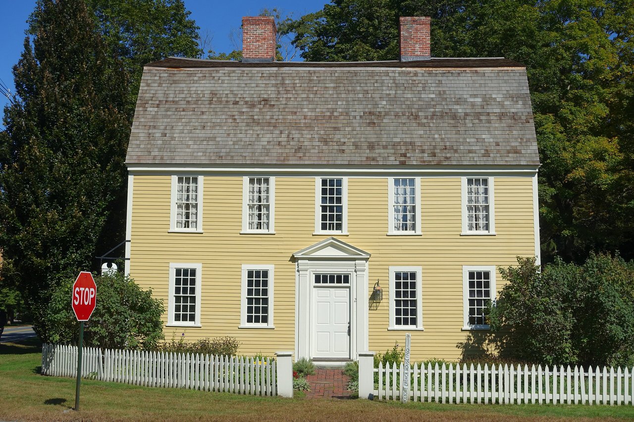
Boxford real estate ranges from 18th-century farmhouses to homes built after World War II on former farms and woodlots. Many 1700s houses survive, most of them two-and-a-half-story, center-chimney Colonials, along with a handful of saltboxes and the gambrel-roofed Holyoke-French House from 1760. Federal homes and five-bay Greek Revival houses from the mid-1800s follow. Since 1955 most of the town has been zoned for single-family homes on lots of at least two acres, and homes use private wells rather than town water.
Boxford has two historic districts, both listed on the National Register in 1973 and both reviewed by the town's Historic District Commission: Boxford Village, the early town center along Main Street and Topsfield Road, and Howe Village, a cluster of 18th- and early 19th-century houses on Ipswich Road. Several other houses are individually listed. Areas include Boxford Village, often called East Boxford, West Boxford around Main and Washington streets, and Howe Village.
About 70 percent of Boxford is wooded, and the volunteer Boxford Trails Association and Boxford Open Land Trust maintain the town's trail system. Boxford State Forest and the neighboring Bald Hill conservation lands near the Middleton line form a large block of woods used for walking and horseback riding, and Willowdale State Forest reaches into town from Topsfield and Ipswich. The Bay Circuit Trail crosses Boxford, and the old railroad bed is open as a trail in sections, connecting to the Topsfield Linear Common.
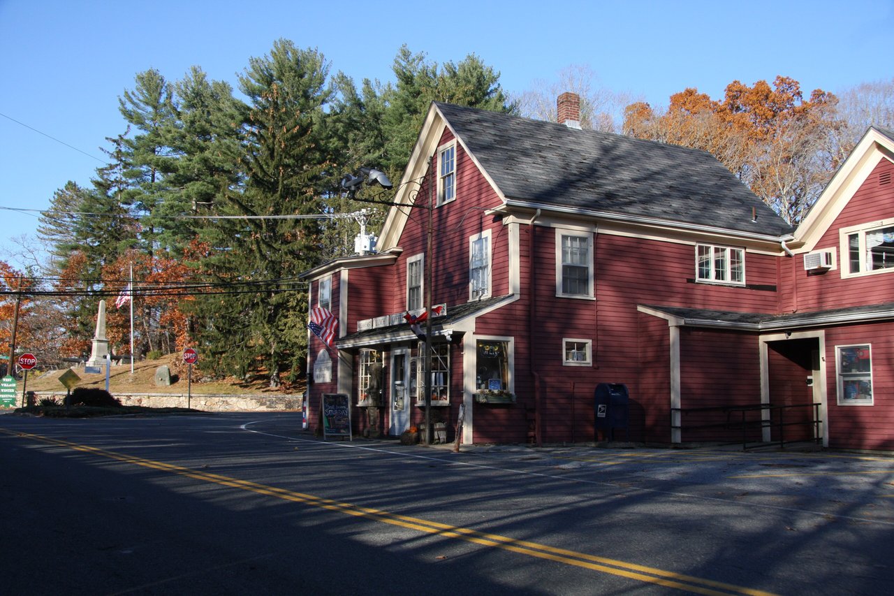
The Boxford Historical Society runs the Holyoke-French House at 2 Topsfield Road and hosts the Apple Festival in the East Village each September and a Grand Illumination each December. Stiles Pond Beach at Keith R. Koster Park is the town beach, with memberships sold to residents, and the town-owned Wildcat Conservation Area off Ipswich Road covers more than 300 acres. Farm stands and stone walls line the back roads, and West Boxford has its own post office and general store.
What kinds of homes are in Boxford?
Boxford has 18th-century Colonials and saltboxes in its historic villages, Federal and Greek Revival farmhouses, and many single-family homes built after World War II. Most of the town is zoned for single-family homes on lots of at least two acres, with private wells.
How do you get to Boston from Boxford?
Boxford has no train station, but commuter rail stations in Rowley, Ipswich, Bradford, Haverhill, and Andover are a short drive away, with direct trains to North Station. By car, I-95 has three exits in town and connects south to Route 128 and I-93.
What are East Boxford and West Boxford?
They are Boxford's two village centers, which grew up around the town's two colonial parishes. Boxford Village, often called East Boxford, is the historic town center along Main Street and Topsfield Road, and West Boxford grew around the 1774 West Parish meetinghouse at Main and Washington streets.
To see homes for sale in Boxford, browse the listings below. Thinking of buying or selling in Boxford? Call (617) 848-9616 or get a free home valuation. Boxford is part of our North of Boston guide.
Photos: TweedPumpkin, CC BY-SA 4.0 and Daderot, public domain, via Wikimedia Commons.
8,250 people live in Boxford, where the median age is 49.3 and the average individual income is $89,834. Data provided by the U.S. Census Bureau.
Total Population
Median Age
Population Density Population Density This is the number of people per square mile in a neighborhood.
Average individual Income
There's plenty to do around Boxford, including shopping, dining, nightlife, parks, and more. Data provided by Walk Score and Yelp.
Explore popular things to do in the area, including Village Store, J Hilburn Massachusetts, and Camp Rotary.
| Name | Category | Distance | Reviews |
Ratings by
Yelp
|
|---|---|---|---|---|
| Dining | 2.89 miles | 0 reviews | 0/5 stars | |
| Shopping | 0.99 miles | 0 reviews | 0/5 stars | |
| Active | 1.01 miles | 8 reviews | 4.4/5 stars | |
| Active | 1.31 miles | 0 reviews | 0/5 stars | |
| Active | 1.89 miles | 0 reviews | 0/5 stars | |
| Active | 2 miles | 1 review | 4/5 stars | |
| Active | 3.21 miles | 0 reviews | 0/5 stars | |
|
|
||||
|
|
||||
|
|
||||
|
|
||||
|
|
||||
|
|
Boxford has 2,783 households, with an average household size of 2.96. Data provided by the U.S. Census Bureau. Here’s what the people living in Boxford do for work — and how long it takes them to get there. Data provided by the U.S. Census Bureau. 8,250 people call Boxford home. The population density is 350 and the largest age group is Data provided by the U.S. Census Bureau.
Total Population
Population Density Population Density This is the number of people per square mile in a neighborhood.
Median Age
Men vs Women
Population by Age Group
0-9 Years
10-17 Years
18-24 Years
25-64 Years
65-74 Years
75+ Years
Education Level
Total Households
Average Household Size
Average individual Income
Households with Children
With Children:
Without Children:
Marital Status
Blue vs White Collar Workers
Blue Collar:
White Collar: