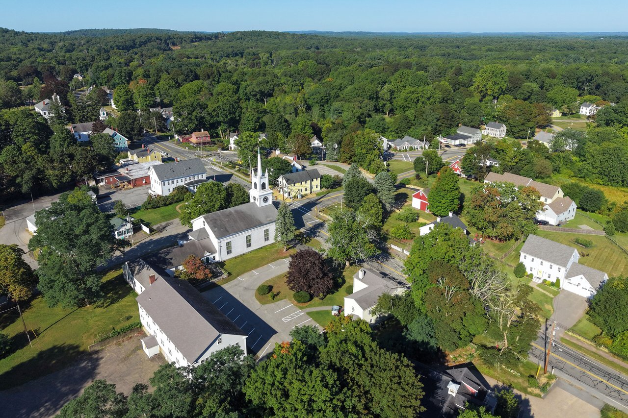
Rowley is a coastal town in Essex County about 30 miles north of Boston, between Ipswich and Newbury. It pairs a historic village center around the Town Common with First Period houses, the salt marshes of the Great Marsh along Plum Island Sound, conservation land along the Mill River, and its own commuter rail station.
Rowley was settled in 1639 by the Reverend Ezekiel Rogers and families from his congregation in Rowley, Yorkshire, and it was incorporated that same year. The original grant stretched west to the Merrimack River and included land that later became Boxford, Georgetown, Groveland, and part of Haverhill. The settlers laid out house lots around the meetinghouse, training field, and burying ground, and many of them were weavers, so cloth became an early trade.
A fulling mill for finishing cloth was running on the Mill River by about 1643, and a 1930 state marker calls it the first in the English colonies. Shoemaking became the main industry in the 1800s, settlers cut salt marsh hay from the marshes for generations, and the railroad arrived in 1840. Rowley borders Newbury to the north, Georgetown to the northwest, Boxford to the west, and Ipswich to the south, with the Great Marsh and Plum Island Sound to the east.
Rowley station on Railroad Avenue is on the Newburyport branch of the MBTA Newburyport/Rockport Line, with direct service to North Station in Boston and a full-length high-level platform. There are no regular MBTA bus routes in town. U.S. Route 1 runs north and south near the middle of town, Route 1A runs through the village center as Main Street, and Route 133 crosses town as Haverhill Street, meeting Route 1 at Kent's Corner. I-95 runs along the western edge of town, with the Route 133 exit just over the line in Georgetown.
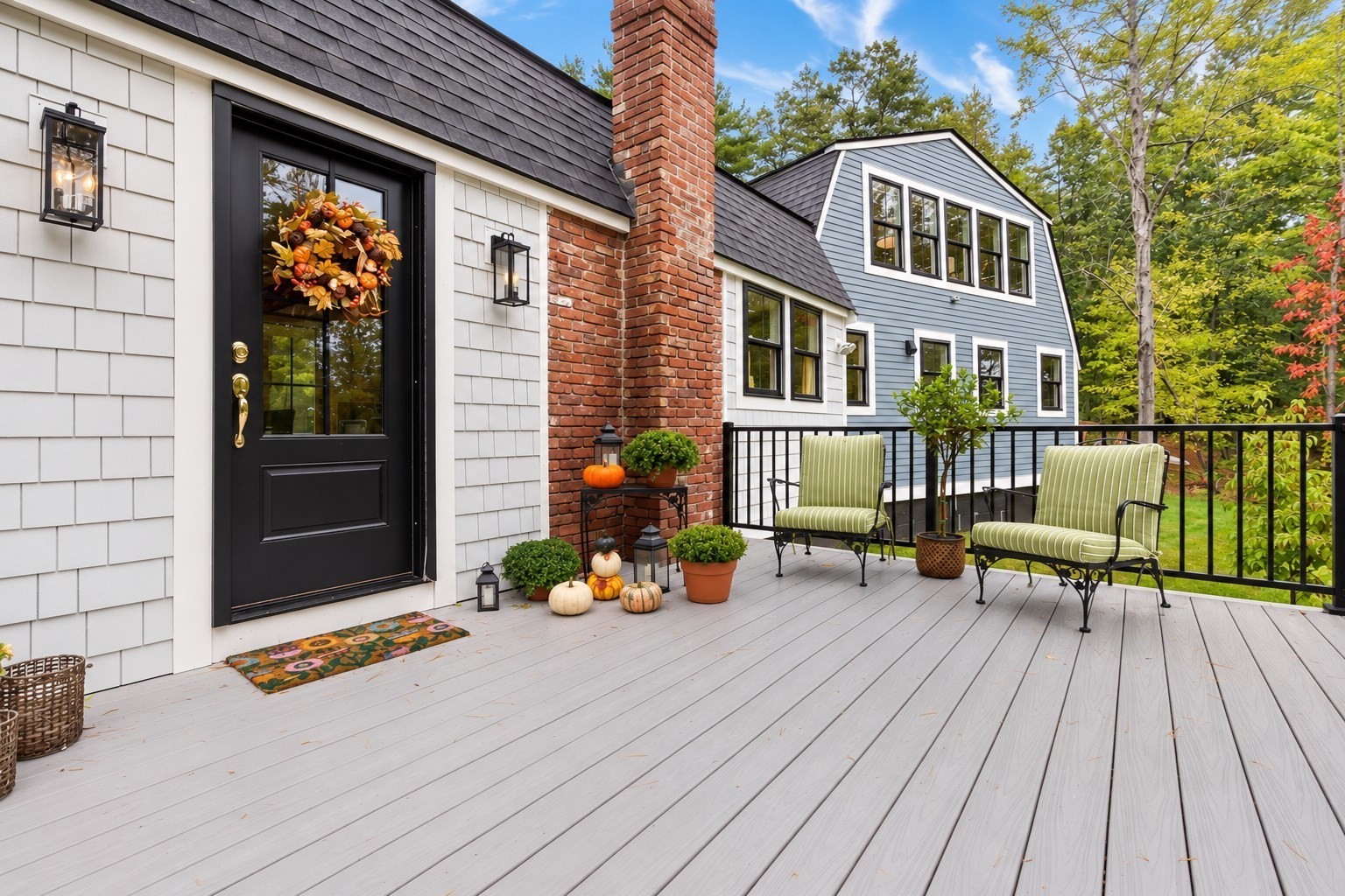
Rowley real estate ranges from houses built in the 1600s to homes from the 20th century. Two-and-a-half-story, five-bay, center-chimney Colonials survive in good numbers, along with a few saltboxes, Federal houses, and Greek Revival and Italianate homes from the mid-1800s, including many three-bay gable-front houses. A few Victorian houses line the Common, and smaller homes and cottages followed in the early 1900s.
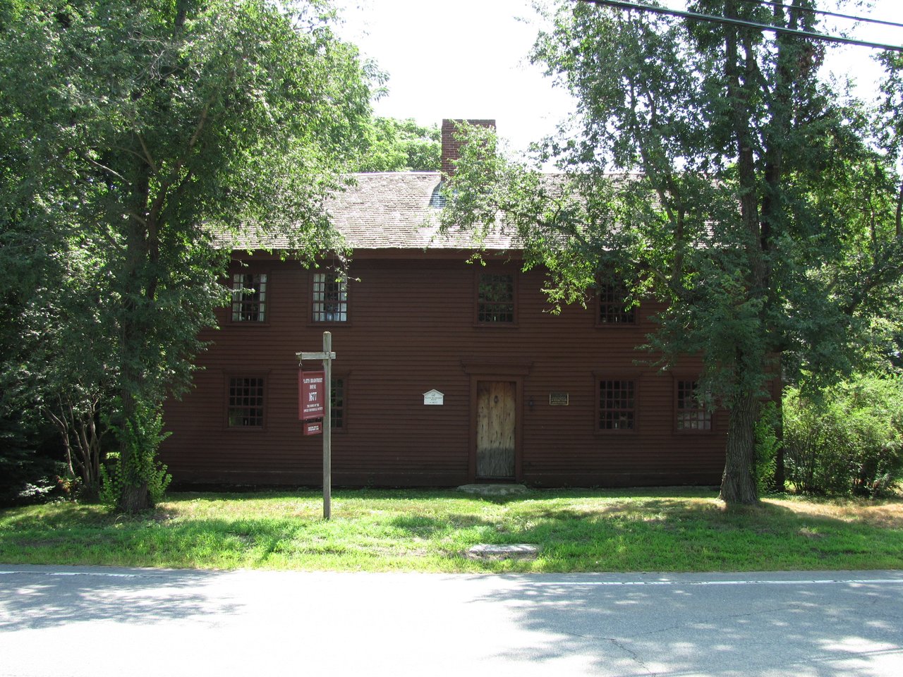
The Chaplin-Clarke House on Haverhill Street, with a section dating to about 1670, and the 1677 Platts-Bradstreet House on Main Street are two of the town's 17th-century houses, and both are listed on the National Register of Historic Places. The town's Historic District Commission oversees local historic districts in Rowley Center and at Glen Mills. Areas include Rowley Center around the Common, Glen Mills on the Mill River, Kent's Corner at Route 1 and Route 133, and the marsh side of town east of Route 1A.
Much of eastern Rowley is salt marsh, part of the Great Marsh on the North Shore, and the Rowley River winds through it to Plum Island Sound. The Rowley Historical Society runs the Platts-Bradstreet House as a museum, and the Agawam Diner, a 1954 diner at Kent's Corner, is listed on the National Register. The Todd Farm Flea Market sets up on Sundays in season in the fields around the Todd Farm barn.
Essex County Greenbelt's Arthur Ewell Reservation on Haverhill Street has easy trails with views of Upper Mill Pond, and the town-owned Dodge Reservation on Wethersfield Street has more than two miles of trails. Georgetown-Rowley State Forest, which straddles I-95, has trails for hiking, mountain biking, and horseback riding, and part of the Bay Circuit Trail. Bradstreet Farm, held by the Bradstreet family for centuries, is now town conservation land along the Rowley River.
What kinds of homes are in Rowley?
Rowley has First Period houses from the late 1600s, center-chimney Colonials and Federal homes around the Common, mid-1800s Greek Revival and gable-front houses, Queen Anne homes, and 20th-century houses and cottages on the roads outside the center.
How do you get to Boston from Rowley?
Rowley station on the MBTA Newburyport/Rockport Line has direct trains to North Station. By car, U.S. Route 1 and Route 1A run south toward Ipswich and Route 128, and I-95 is reached via Route 133 in Georgetown.
What is the Great Marsh?
The Great Marsh is the large salt marsh system along the coast north of Cape Ann, and much of eastern Rowley is part of it. The state lists Rowley as one of five towns in the Great Marsh Area of Critical Environmental Concern.
To see homes for sale in Rowley, browse the listings below. Thinking of buying or selling in Rowley? Call (617) 848-9616 or get a free home valuation. Rowley is part of our North of Boston guide.
Photos: Quintin Soloviev, CC BY 4.0 and John Phelan, CC BY 3.0, via Wikimedia Commons.
6,251 people live in Rowley, where the median age is 50 and the average individual income is $71,507. Data provided by the U.S. Census Bureau.
Total Population
Median Age
Population Density Population Density This is the number of people per square mile in a neighborhood.
Average individual Income
There's plenty to do around Rowley, including shopping, dining, nightlife, parks, and more. Data provided by Walk Score and Yelp.
Explore popular things to do in the area, including Cook's Package Store, Three Sweet Peas Bakery Cafe, and Rowley Food Pantry.
| Name | Category | Distance | Reviews |
Ratings by
Yelp
|
|---|---|---|---|---|
| Dining | 0.59 miles | 0 reviews | 0/5 stars | |
| Dining | 0.62 miles | 33 reviews | 4.5/5 stars | |
| Dining | 0.66 miles | 0 reviews | 0/5 stars | |
| Dining | 0.68 miles | 0 reviews | 0/5 stars | |
| Dining | 0.8 miles | 139 reviews | 4.2/5 stars | |
| Dining | 0.83 miles | 0 reviews | 0/5 stars | |
| Dining | 0.89 miles | 0 reviews | 0/5 stars | |
| Dining | 0.93 miles | 0 reviews | 0/5 stars | |
| Dining | 1.04 miles | 0 reviews | 0/5 stars | |
| Dining | 1.15 miles | 19 reviews | 2.7/5 stars | |
| Shopping | 0.7 miles | 0 reviews | 0/5 stars | |
| Shopping | 0.89 miles | 43 reviews | 4.3/5 stars | |
| Active | 0.61 miles | 0 reviews | 0/5 stars | |
| Active | 0.95 miles | 0 reviews | 0/5 stars | |
| Active | 1.04 miles | 2 reviews | 3.5/5 stars | |
| Active | 1.2 miles | 0 reviews | 0/5 stars | |
| Beauty | 0.54 miles | 0 reviews | 0/5 stars | |
| Beauty | 0.95 miles | 5 reviews | 5/5 stars | |
| Beauty | 1.08 miles | 46 reviews | 3.5/5 stars | |
| Beauty | 1.08 miles | 5 reviews | 5/5 stars | |
| Beauty | 1.17 miles | 0 reviews | 0/5 stars | |
| Beauty | 1.17 miles | 1 review | 5/5 stars | |
|
|
||||
|
|
||||
|
|
||||
|
|
||||
|
|
||||
|
|
Rowley has 2,447 households, with an average household size of 2.54. Data provided by the U.S. Census Bureau. Here’s what the people living in Rowley do for work — and how long it takes them to get there. Data provided by the U.S. Census Bureau. 6,251 people call Rowley home. The population density is 343 and the largest age group is Data provided by the U.S. Census Bureau.
Total Population
Population Density Population Density This is the number of people per square mile in a neighborhood.
Median Age
Men vs Women
Population by Age Group
0-9 Years
10-17 Years
18-24 Years
25-64 Years
65-74 Years
75+ Years
Education Level
Total Households
Average Household Size
Average individual Income
Households with Children
With Children:
Without Children:
Marital Status
Blue vs White Collar Workers
Blue Collar:
White Collar: