Hull is a town in Plymouth County on the Nantasket Peninsula, at the southern entrance to Boston Harbor. It is about 20 miles from downtown Boston by road and much closer by water. Hull pairs Nantasket Beach along its ocean side with Hull Village and Pemberton Point at the northern tip, neighborhoods like Allerton, Kenberma, and Strawberry Hill, Fort Revere on Telegraph Hill, and an MBTA ferry to Boston.
The Native name Nantasket is usually translated as "low-tide place" or "at the strait." English traders and settlers were here by the 1620s, and Hull was incorporated in 1644, named for Kingston upon Hull in England. For generations it was a small fishing and farming town. In 1776 Telegraph Hill was fortified to guard the harbor, and the site later became Fort Revere, used through 1947.
In 1889 the Point Allerton Life-Saving Station opened with Hull native Joshua James as its first keeper, and his crews led many rescues off the coast. From the 1800s Nantasket Beach became a summer destination, with hotels, steamboats from Boston, and a railroad that ran down the peninsula. Paragon Park opened on the beach in 1905 and closed in 1984, and its 1928 carousel still turns today. Hull sits at the tip of a peninsula with Massachusetts Bay on the ocean side, Hingham Bay and Boston Harbor on the bay side, and Cohasset and Hingham to the south.
The MBTA Hingham/Hull Ferry leaves from Pemberton Point on Main Street for Long Wharf in downtown Boston, with weekday service year-round, select trips stopping at Logan Airport, and a separate weekend schedule. Direct trips to Long Wharf take about half an hour. MBTA bus route 714 connects the ferry with Hingham, with some trips via Nantasket Junction station on the Greenbush Line in Hingham. By car, Nantasket Avenue (Route 228) and George Washington Boulevard lead off the peninsula to Route 3A in Hingham. Many residential streets require a town parking sticker or visitor pass.
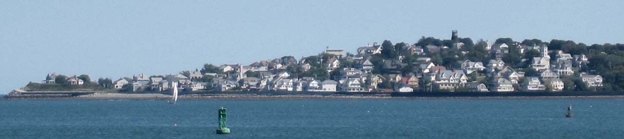
Hull real estate is a mix of converted summer cottages, early 1900s houses, condominiums, and postwar homes. Land companies laid out most of the streets in the 1880s, and summer houses filled Atlantic Hill, Allerton Hill, and the beach neighborhoods by the early 1900s. Bungalows followed after 1915, and the town saw its biggest growth from 1950 to 1965. Condominiums stand on the former Paragon Park site and on Spinnaker Island, a small island connected by a bridge.
Much of Hull is low-lying coastal land, and buyers should check the FEMA flood map for any specific address. National Register listings include Telegraph Hill, the Point Allerton Life-Saving Station, the Paragon Park Carousel, and Hull Shore Drive along Nantasket Beach. Areas include Hull Village and Pemberton Point, Allerton and Point Allerton, Kenberma, Strawberry Hill, the Nantasket Beach area, and Green Hill near the Cohasset line.
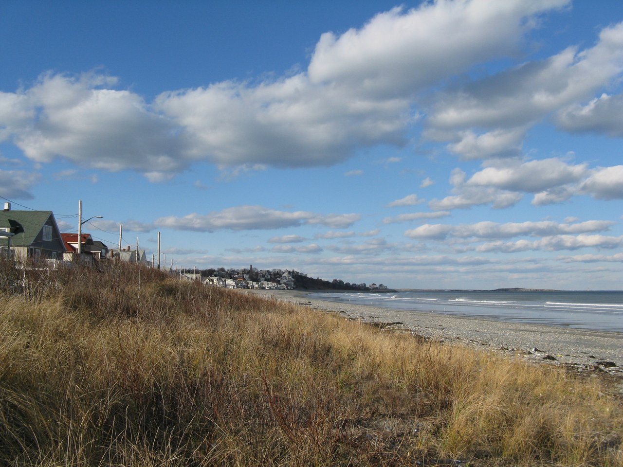
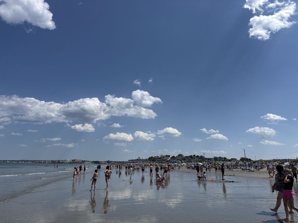
Nantasket Beach Reservation, run by the state, has about a mile of Atlantic shoreline with a bathhouse, pavilion, lifeguards in summer, and concerts on summer evenings, and the beach shows wide flats and tide pools at low tide. The Paragon Park Carousel, built in 1928, still runs near the beach on Wharf Avenue. Fort Revere Park on Telegraph Hill has picnic areas and views across Boston Harbor toward the islands and Boston Light.
The Hull Lifesaving Museum occupies the restored 1889 Point Allerton station on Nantasket Avenue and runs a rowing program at Pemberton Point. The Weir River estuary, a protected salt marsh area, lies between Hull, Hingham, and Cohasset, and Peddocks Island, part of the Boston Harbor Islands, is part of Hull. The Hull Public Library on Main Street is in the former summer home of writer John Boyle O'Reilly.
How do you get to Boston from Hull?
The MBTA Hingham/Hull Ferry runs from Pemberton Point to Long Wharf in downtown Boston, with year-round weekday service and select trips to Logan Airport. By car, Route 228 and Route 3A lead to Route 3 and I-93.
What kinds of homes are in Hull?
Hull has converted summer cottages, early 1900s houses on its hills, bungalows, postwar homes, and condominiums, including those on the former Paragon Park site and Spinnaker Island.
Is Boston Light in Hull?
No. Boston Light stands on Little Brewster Island, part of the city of Boston, but it is visible from Hull's northern shore and Fort Revere Park.
To see homes for sale in Hull, browse the listings below. Thinking of buying or selling in Hull? Call (617) 848-9616 or get a free home valuation. Hull is part of our South Shore guide.
Photos: John Phelan, CC BY-SA 3.0 and M2545, public domain, via Wikimedia Commons.
10,138 people live in Hull, where the median age is 56.1 and the average individual income is $76,608. Data provided by the U.S. Census Bureau.
Total Population
Median Age
Population Density Population Density This is the number of people per square mile in a neighborhood.
Average individual Income
There's plenty to do around Hull, including shopping, dining, nightlife, parks, and more. Data provided by Walk Score and Yelp.
Explore popular things to do in the area, including Liberty Foods, Port Side Wines, and The Village Market.
| Name | Category | Distance | Reviews |
Ratings by
Yelp
|
|---|---|---|---|---|
| Dining | 0.07 miles | 0 reviews | 0/5 stars | |
| Dining | 0.35 miles | 0 reviews | 0/5 stars | |
| Dining · $$$ | 0.37 miles | 16 reviews | 2.7/5 stars | |
| Dining | 0.56 miles | 2 reviews | 3/5 stars | |
| Dining | 0.74 miles | 0 reviews | 0/5 stars | |
| Dining | 0.75 miles | 0 reviews | 0/5 stars | |
| Dining | 1.77 miles | 0 reviews | 0/5 stars | |
| Dining | 1.78 miles | 0 reviews | 0/5 stars | |
| Dining | 1.83 miles | 2 reviews | 2/5 stars | |
| Active | 0.25 miles | 1 review | 5/5 stars | |
| Active | 0.25 miles | 0 reviews | 0/5 stars | |
| Active | 0.31 miles | 0 reviews | 0/5 stars | |
| Active | 0.49 miles | 0 reviews | 0/5 stars | |
| Active | 0.51 miles | 0 reviews | 0/5 stars | |
| Active | 0.61 miles | 0 reviews | 0/5 stars | |
| Active | 1.15 miles | 0 reviews | 0/5 stars | |
| Active | 1.53 miles | 118 reviews | 3.8/5 stars | |
| Active | 1.67 miles | 0 reviews | 0/5 stars | |
| Active | 1.8 miles | 2 reviews | 5/5 stars | |
| Active | 1.92 miles | 1 review | 5/5 stars | |
| Beauty | 0.36 miles | 5 reviews | 4.8/5 stars | |
| Beauty | 1.09 miles | 0 reviews | 0/5 stars | |
| Beauty | 1.61 miles | 0 reviews | 0/5 stars | |
| Beauty | 1.81 miles | 0 reviews | 0/5 stars | |
|
|
||||
|
|
||||
|
|
||||
|
|
||||
|
|
||||
|
|
Hull has 4,709 households, with an average household size of 2.15. Data provided by the U.S. Census Bureau. Here’s what the people living in Hull do for work — and how long it takes them to get there. Data provided by the U.S. Census Bureau. 10,138 people call Hull home. The population density is 3,530 and the largest age group is Data provided by the U.S. Census Bureau.
Total Population
Population Density Population Density This is the number of people per square mile in a neighborhood.
Median Age
Men vs Women
Population by Age Group
0-9 Years
10-17 Years
18-24 Years
25-64 Years
65-74 Years
75+ Years
Education Level
Total Households
Average Household Size
Average individual Income
Households with Children
With Children:
Without Children:
Marital Status
Blue vs White Collar Workers
Blue Collar:
White Collar: