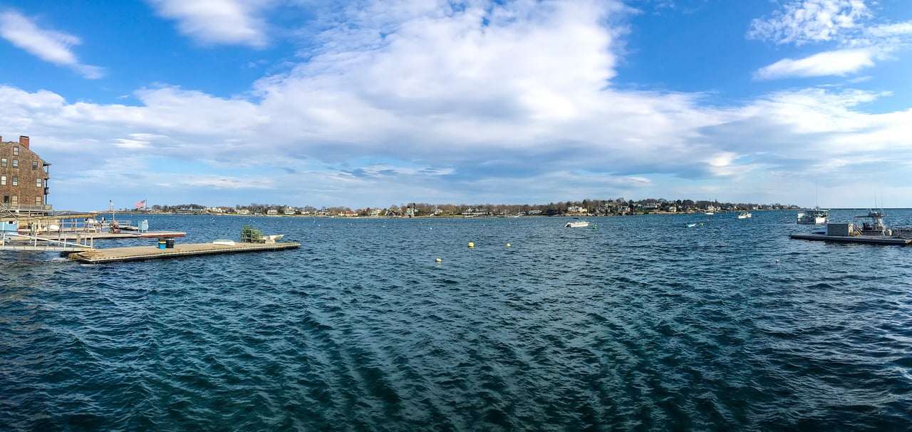
Marblehead is a coastal town in Essex County about 17 miles northeast of Boston, set on a rocky peninsula in Massachusetts Bay. It has hundreds of houses built before the Revolution, a busy harbor known for sailing, and beaches and waterfront parks on almost every side of town.
Fishermen, many of them from the Channel Islands, settled here around 1629 as part of Salem, and early names for the place included Marble Harbor, likely after the rocky ledges. Marblehead became an independent town in 1649. By the early 1700s it was one of the leading fishing ports in New England, and in the 1800s shoemaking took over as the main industry. From the late 1860s Marblehead Neck became a summer resort, and the town grew into a yachting center.
During the Revolution, General John Glover's Marblehead regiment ferried George Washington's army across the East River in 1776 and rowed it across the Delaware on Christmas night that year. In 1814, USS Constitution took shelter in the harbor under the guns of Fort Sewall while chased by two British frigates. Marblehead borders Salem to the northwest and Swampscott to the south, with water on its other sides.
Marblehead has no commuter rail station, and the closest stops are Swampscott and Salem on the MBTA Newburyport/Rockport Line, with service to North Station. MBTA bus routes 441 and 442 run from Marblehead through Swampscott and Lynn to Wonderland station on the Blue Line. Route 114 heads west into Salem and Route 129 runs south through Swampscott, and the Marblehead Rail Trail follows the old railroad beds to the Salem bike path.
Marblehead real estate is built around Old Town, where hundreds of houses from the late 1600s to the Revolution sit close to one another and to the street. Center-chimney houses, many with gambrel roofs, and narrow three-bay half houses are common, along with Georgian merchant houses like the 1768 Jeremiah Lee Mansion. Federal, Greek Revival, and Italianate houses fill the streets laid out in the 1800s.
Marblehead Neck, reached by a causeway, has Queen Anne, Shingle Style, and Colonial Revival homes, with large estates along its Atlantic side. Clifton grew around its own railroad depot after 1870, and West Shore Drive opened the Salem Harbor shore to development in the early 1900s. The Old Town and Gingerbread Hill local historic districts review exterior changes visible from the street. Neighborhoods include Old Town, Marblehead Neck, Clifton, Devereux, Peach's Point, and the Farms.
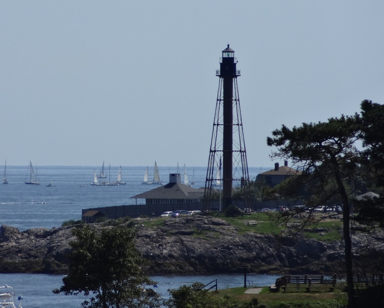
At the harbor entrance, Fort Sewall is a public park with original bunkers and wide harbor views, and Crocker Park overlooks the harbor with a gazebo and summer concerts. At the tip of the Neck, Chandler Hovey Park surrounds Marblehead Light, a 105-foot cast-iron tower first lit in 1896 and the only tower of its kind in New England. Seaside Park on Atlantic Avenue covers more than 33 acres with fields and courts.
Devereux Beach sits by the causeway to the Neck, and Riverhead, Grace Oliver, Gas House, and Fort beaches line the harbor and coves. At low tide you can walk across the flats to Crowninshield Island, a five-acre Trustees of Reservations property. Abbot Hall, the town hall completed in 1877, displays the painting The Spirit of '76 and the town's original 1684 deed.
What kinds of homes are in Marblehead?
Marblehead has hundreds of colonial houses in Old Town, many with gambrel roofs, plus Georgian merchant houses and Federal and Greek Revival homes from the 1800s. Marblehead Neck has Shingle Style and Colonial Revival homes and oceanfront estates, and Clifton and the Salem Harbor shore have early 1900s houses.
How do you get to Boston from Marblehead?
Marblehead has no train station, but Swampscott and Salem stations on the MBTA Newburyport/Rockport Line have direct trains to North Station. MBTA bus routes 441 and 442 connect Marblehead with Wonderland station on the Blue Line.
What is Marblehead Neck?
Marblehead Neck is a near-island connected to the rest of town by a causeway at Devereux Beach. It became a summer resort in the late 1800s and today has Shingle Style and Colonial Revival homes, oceanfront estates, Castle Rock Park, and Chandler Hovey Park with Marblehead Light.
To see homes for sale in Marblehead, browse the listings below. Thinking of buying or selling in Marblehead? Call (617) 848-9616 or get a free home valuation. Marblehead is part of our North of Boston guide.
Photos: Fletcher, CC BY 4.0 and Elizabeth B. Thomsen, CC BY-SA 3.0, via Wikimedia Commons.
20,413 people live in Marblehead, where the median age is 49.1 and the average individual income is $103,980. Data provided by the U.S. Census Bureau.
Total Population
Median Age
Population Density Population Density This is the number of people per square mile in a neighborhood.
Average individual Income
There's plenty to do around Marblehead, including shopping, dining, nightlife, parks, and more. Data provided by Walk Score and Yelp.
Explore popular things to do in the area, including Chocolate by Design At Shubie's, Fast Break, and Foster's.
| Name | Category | Distance | Reviews |
Ratings by
Yelp
|
|---|---|---|---|---|
| Dining | 0.4 miles | 0 reviews | 0/5 stars | |
| Dining | 0.44 miles | 0 reviews | 0/5 stars | |
| Shopping | 0.26 miles | 0 reviews | 0/5 stars | |
| Shopping | 0.35 miles | 1 review | 2/5 stars | |
| Shopping | 0.38 miles | 0 reviews | 0/5 stars | |
| Shopping | 0.73 miles | 5 reviews | 5/5 stars | |
| Shopping | 0.82 miles | 1 review | 4/5 stars | |
| Active | 0.29 miles | 0 reviews | 0/5 stars | |
| Active | 0.33 miles | 0 reviews | 0/5 stars | |
| Active | 0.44 miles | 5 reviews | 4.2/5 stars | |
| Active | 0.66 miles | 1 review | 4/5 stars | |
| Active | 0.81 miles | 0 reviews | 0/5 stars | |
| Active | 0.81 miles | 0 reviews | 0/5 stars | |
| Active | 0.82 miles | 0 reviews | 0/5 stars | |
| Active | 0.82 miles | 1 review | 5/5 stars | |
| Beauty | 0.17 miles | 5 reviews | 5/5 stars | |
| Beauty | 0.17 miles | 1 review | 4/5 stars | |
| Beauty | 0.18 miles | 2 reviews | 1/5 stars | |
| Beauty | 0.33 miles | 4 reviews | 4/5 stars | |
| Beauty | 0.38 miles | 18 reviews | 4.1/5 stars | |
| Beauty | 0.4 miles | 0 reviews | 0/5 stars | |
| Beauty | 0.44 miles | 0 reviews | 0/5 stars | |
| Beauty | 0.44 miles | 0 reviews | 0/5 stars | |
| Beauty | 0.44 miles | 0 reviews | 0/5 stars | |
|
|
||||
|
|
||||
|
|
||||
|
|
||||
|
|
||||
|
|
Marblehead has 8,289 households, with an average household size of 2.45. Data provided by the U.S. Census Bureau. Here’s what the people living in Marblehead do for work — and how long it takes them to get there. Data provided by the U.S. Census Bureau. 20,413 people call Marblehead home. The population density is 4,662 and the largest age group is Data provided by the U.S. Census Bureau.
Total Population
Population Density Population Density This is the number of people per square mile in a neighborhood.
Median Age
Men vs Women
Population by Age Group
0-9 Years
10-17 Years
18-24 Years
25-64 Years
65-74 Years
75+ Years
Education Level
Total Households
Average Household Size
Average individual Income
Households with Children
With Children:
Without Children:
Marital Status
Blue vs White Collar Workers
Blue Collar:
White Collar: