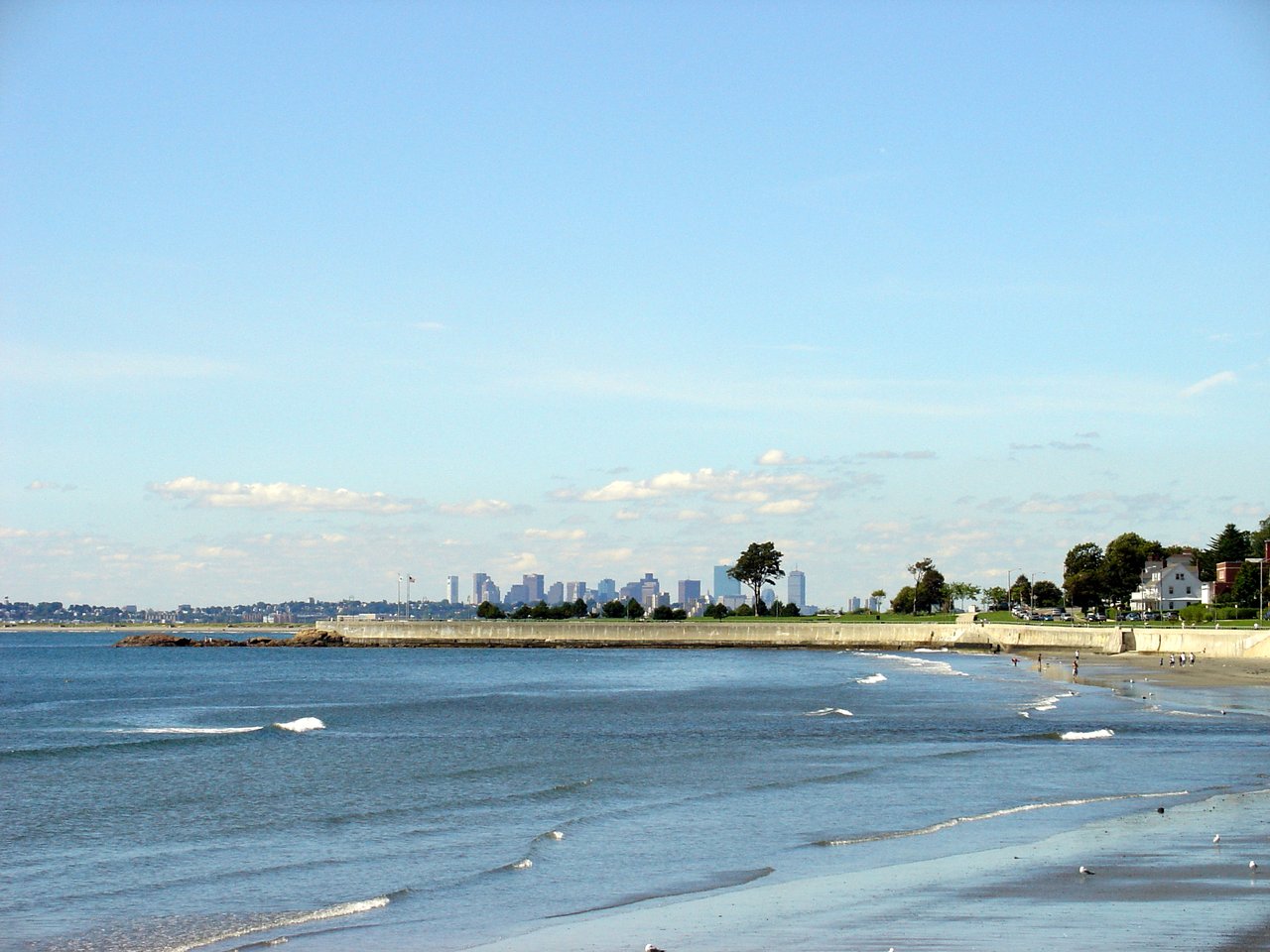
Swampscott is a small coastal town in Essex County about 12 miles northeast of Boston, set on Nahant Bay and Massachusetts Bay. It pairs a rocky shoreline and six public beaches with walkable streets of Victorian and Colonial Revival homes and a commuter rail stop with direct trains to Boston.
European settlement began in 1629, when Francis Ingalls built a tannery on Humphrey's Brook. For more than two centuries the area was part of Lynn, and Swampscott was set off as a separate town in 1852. Fishing shaped the early village, and lobster trapping here dates to about 1808. The Eastern Railroad arrived in 1838, and by the late 1800s Swampscott had become a summer resort with hotels and large shore estates.
Elihu Thomson, a co-founder of the Thomson-Houston Electric Company, which became part of General Electric, built his home here in 1889, and it now serves as Town Hall. President Calvin Coolidge used the White Court estate as his summer White House. Swampscott borders Lynn to the southwest, Salem to the northwest, and Marblehead to the northeast, with Nahant Bay and Massachusetts Bay along its shore.
Swampscott station, at Burrill Street and Railroad Avenue on the MBTA Newburyport/Rockport Line, has direct service to North Station in Boston. MBTA bus routes 441 and 442 run along Paradise Road and Humphrey Street to Wonderland station on the Blue Line. Route 1A (Paradise Road) and Route 129 (Humphrey Street and Atlantic Avenue) pass through town.
Swampscott real estate ranges from a handful of 18th-century houses to postwar ranches. Center-chimney Federal houses and Greek Revival and Italianate homes survive from the fishing and early resort years. The late 1800s brought gable-front houses, two-family homes, and shoe workers' cottages near Burrill Street, along with summer estates in Queen Anne, Shingle Style, and Colonial Revival styles along the shore.
The Olmsted Subdivision Historic District, planned in 1888 on a former estate, has curving roads, landscaped traffic islands, and Queen Anne and Shingle Style houses around Monument Avenue. Puritan Road keeps many of its large oceanfront estates. Neighborhoods include Monument Square, the Olmsted District, Puritan Road, Phillips Beach, Beach Bluff, Vinnin Square, and the Humphrey Street area, with condominiums on several former estate sites.
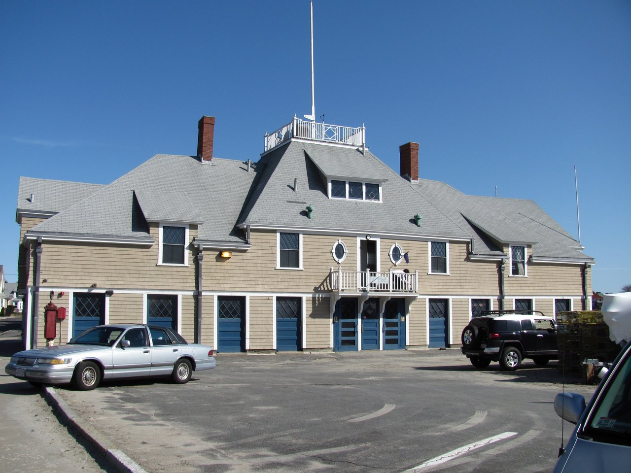
The town has six public beaches. King's Beach runs along Humphrey Street from the Lynn line, Fisherman's Beach has a pier and boat ramp, and Phillips Beach on Ocean Avenue is the largest. Eisman's, Preston, and Whales beaches fill out the shore. On Fisherman's Beach, the Swampscott Fish House, a Shingle Style building from the 1890s, is still used to store fishing gear.
The Harold King Town Forest covers 47 acres in the northwest corner of town, and the Palmer Pond Wildlife Conservation Area protects about 18 acres near Phillips Beach. The Swampscott Historical Society is based in the John Humphreys House, an early 18th-century house on Paradise Road, and the 1868 railroad depot is on the National Register of Historic Places.
What kinds of homes are in Swampscott?
Swampscott has Federal and Greek Revival houses from its fishing years, Queen Anne and Shingle Style homes in the Olmsted District, and large oceanfront estates on Puritan Road. Two-family houses, Colonial Revival and Cape houses, postwar ranches near Phillips Beach, and condominiums add variety.
How do you get to Boston from Swampscott?
Swampscott station on the MBTA Newburyport/Rockport Line has direct trains to North Station. MBTA bus routes 441 and 442 connect the town with Wonderland station on the Blue Line.
What is the Olmsted District in Swampscott?
The Olmsted Subdivision Historic District is a neighborhood planned in 1888 on a former 130-acre estate, with curving streets and landscaped traffic islands around Monument Avenue. It has many Queen Anne and Shingle Style houses and was listed on the National Register of Historic Places in 2002.
To see homes for sale in Swampscott, browse the listings below. Thinking of buying or selling in Swampscott? Call (617) 848-9616 or get a free home valuation. Swampscott is part of our North of Boston guide.
Photos: Ethomsen, CC BY-SA 4.0 and John Phelan, CC BY 3.0, via Wikimedia Commons.
15,277 people live in Swampscott, where the median age is 44.5 and the average individual income is $78,590. Data provided by the U.S. Census Bureau.
Total Population
Median Age
Population Density Population Density This is the number of people per square mile in a neighborhood.
Average individual Income
There's plenty to do around Swampscott, including shopping, dining, nightlife, parks, and more. Data provided by Walk Score and Yelp.
Explore popular things to do in the area, including Auburn Mall, Burke’s Fitness, and Future Fitness.
| Name | Category | Distance | Reviews |
Ratings by
Yelp
|
|---|---|---|---|---|
| Shopping | 1.2 miles | 3 reviews | 3/5 stars | |
| Active | 1.52 miles | 9 reviews | 3.4/5 stars | |
| Active | 1.68 miles | 0 reviews | 0/5 stars | |
| Beauty | 0.34 miles | 0 reviews | 0/5 stars | |
| Beauty | 0.37 miles | 8 reviews | 3/5 stars | |
| Beauty | 0.68 miles | 0 reviews | 0/5 stars | |
| Beauty | 0.9 miles | 4 reviews | 3/5 stars | |
| Beauty | 0.91 miles | 0 reviews | 0/5 stars | |
| Beauty | 1.09 miles | 1 review | 5/5 stars | |
| Beauty | 1.16 miles | 1 review | 4/5 stars | |
| Beauty | 1.24 miles | 0 reviews | 0/5 stars | |
| Beauty | 1.31 miles | 0 reviews | 0/5 stars | |
| Beauty | 1.4 miles | 0 reviews | 0/5 stars | |
| Beauty | 1.59 miles | 18 reviews | 4.8/5 stars | |
|
|
||||
|
|
||||
|
|
||||
|
|
||||
|
|
||||
|
|
Swampscott has 6,155 households, with an average household size of 2.46. Data provided by the U.S. Census Bureau. Here’s what the people living in Swampscott do for work — and how long it takes them to get there. Data provided by the U.S. Census Bureau. 15,277 people call Swampscott home. The population density is 5,055 and the largest age group is Data provided by the U.S. Census Bureau.
Total Population
Population Density Population Density This is the number of people per square mile in a neighborhood.
Median Age
Men vs Women
Population by Age Group
0-9 Years
10-17 Years
18-24 Years
25-64 Years
65-74 Years
75+ Years
Education Level
Total Households
Average Household Size
Average individual Income
Households with Children
With Children:
Without Children:
Marital Status
Blue vs White Collar Workers
Blue Collar:
White Collar: