Scituate is a seaside town in Plymouth County about 25 miles southeast of Boston by road, roughly midway between Boston and Plymouth. It pairs Scituate Harbor, a working harbor with shops and restaurants along Front Street, with North Scituate, Greenbush, Minot, and Humarock, five public beaches, the North River, Old Scituate Light, and two stations on the Greenbush commuter rail line.
The name comes from Satuit, a Native word understood to mean "cold brook," for the brook that runs into the inner harbor. English settlers from Plymouth Colony and from County Kent, England, arrived in the late 1620s and early 1630s and laid out Kent Street, which still carries the name. Scituate was incorporated in 1636. Over time its western lands became Hanover, and in 1849 South Scituate, now Norwell, was set off as its own town. Shipbuilding on the North River and fishing carried the town through the 1700s and 1800s.
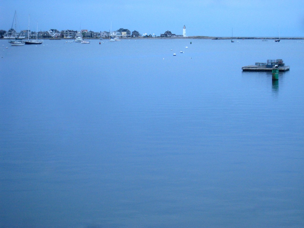
Scituate Light was built in 1810 and 1811, and local tradition holds that during the War of 1812 the keeper's daughters, Rebecca and Abigail Bates, played fife and drum behind the dunes and turned back a British landing party. The light became known as the home of the "Army of Two." Irish moss harvesting began here in 1847, the railroad arrived in 1871, and summer cottages spread along the beaches. The Portland Gale of November 1898 cut a new mouth for the North River, leaving Humarock reachable by land only through Marshfield. Scituate borders Cohasset to the northwest, Hingham and Norwell to the west, and Marshfield to the south, with Massachusetts Bay along its eastern edge.
Scituate has two MBTA Greenbush Line stations, North Scituate on Country Way and Greenbush on the Old Driftway, the end of the line. Trains run to South Station by way of Cohasset, Hingham, Weymouth, and Quincy, and the ride takes about an hour. There is no MBTA bus service in town. Route 3A, the Chief Justice Cushing Highway, runs north and south through Scituate, Route 123 heads west from Greenbush toward Norwell, and Route 3 is a short drive west in Norwell. Scituate Harbor has a town pier, moorings, and a harbormaster's office on Cole Parkway.
Scituate real estate is mostly single-family homes, from colonial houses to beach cottages and postwar neighborhoods. Cape Cod cottages and five-bay double houses date from the colonial era, Federal houses with brick end chimneys stand around Scituate Harbor, Greenbush, and Common Street, and Greek Revival side-hall cottages followed in the mid-1800s. Queen Anne cottages from the 1880s and 1890s survive at Minot, shingled Colonial Revival and Craftsman beach houses and bungalows came in the early 1900s, and much of the town grew after World War II.
Summer colonies shaped several areas, including Minot, Third Cliff, Sand Hills, and Humarock, and the Glades in North Scituate is a private area that began as a hotel in 1846. Dreamwold, the former estate of financier Thomas Lawson in Egypt, is now condominiums. Scituate takes part in FEMA's Community Rating System for flood insurance. Areas include Scituate Harbor, North Scituate, Minot, Egypt, Greenbush, the Cliffs, and Humarock.
Scituate's five public beaches are Minot, Sand Hills, Egypt, Peggotty, and Humarock. Beach parking requires a sticker from Memorial Day to Labor Day, with resident stickers and limited nonresident options sold online. Scituate Harbor has a working fishing fleet, recreational boating, and shops and restaurants along Front Street, and the Widow's Walk Golf Course, a town-owned 18-hole course on the Driftway, sits next to the North River.
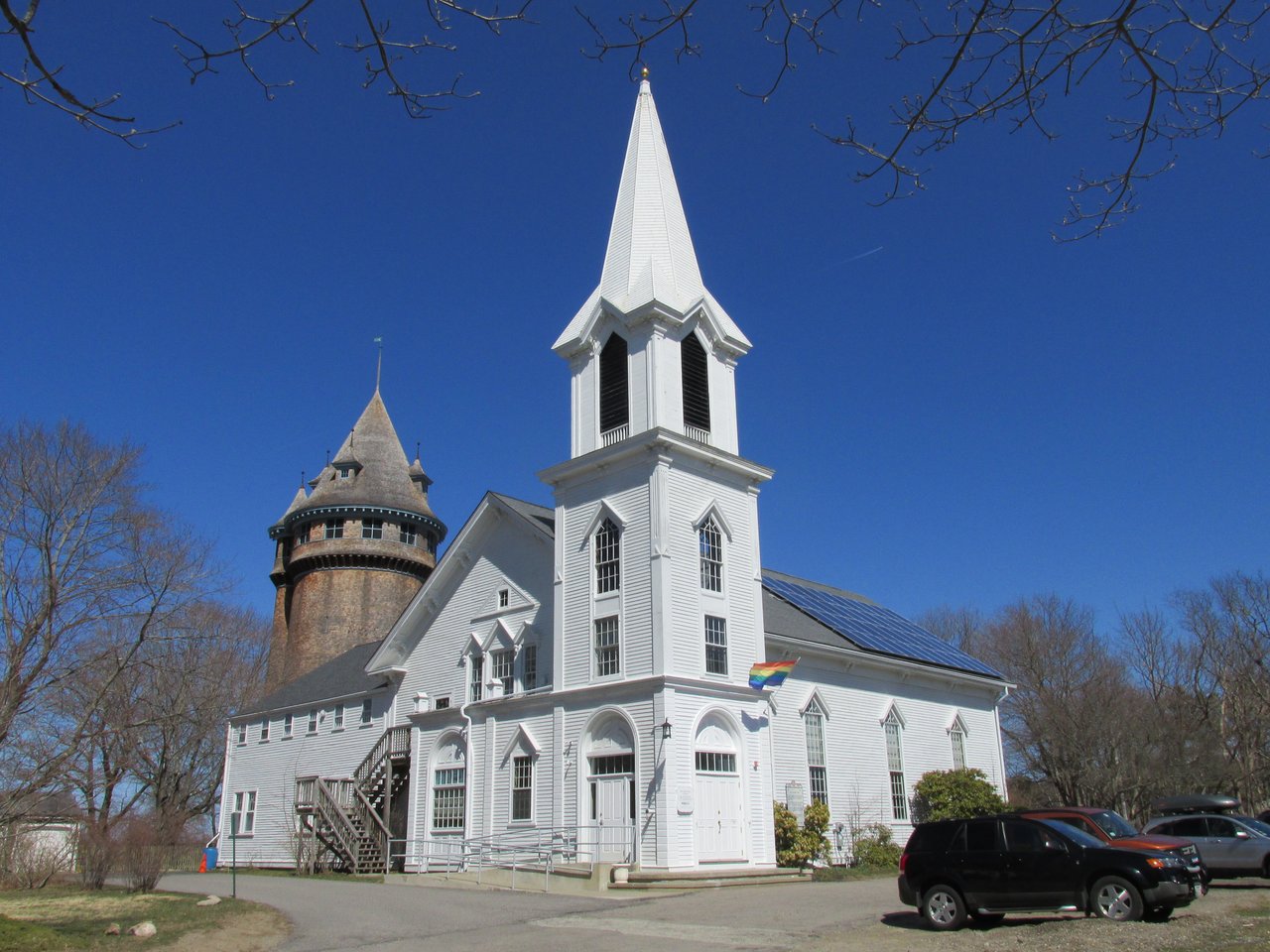
The Scituate Historical Society runs Old Scituate Light, the 1902 Lawson Tower, which was built to enclose a town water tank, the Cudworth House, and the Maritime and Irish Mossing Museum on the Driftway. The Scituate Town Library is on Branch Street. Heritage Days fills the harbor each August, and the St. Patrick's Day parade runs to Scituate Harbor each March.
How do you get to Boston from Scituate?
North Scituate and Greenbush stations are on the MBTA Greenbush Line, with trains to South Station in about an hour. By car, Route 3A and Route 3 lead north toward Boston.
Do you need a sticker for Scituate beaches?
Yes, beach parking requires a sticker from Memorial Day to Labor Day. Residents can buy stickers from the town, and a limited number of nonresident stickers are sold online. Check the town's current rules before you go.
Why is Humarock cut off from the rest of Scituate?
The Portland Gale of November 1898 cut a new mouth for the North River between Third and Fourth Cliffs. Since then, Humarock has been reachable by road only through Marshfield.
To see homes for sale in Scituate, browse the listings below. Thinking of buying or selling in Scituate? Call (617) 848-9616 or get a free home valuation. Scituate is part of our South Shore guide.
Photos: John Phelan, CC BY-SA 3.0 and Daderot, public domain, via Wikimedia Commons.
19,099 people live in Scituate, where the median age is 47.5 and the average individual income is $84,296. Data provided by the U.S. Census Bureau.
Total Population
Median Age
Population Density Population Density This is the number of people per square mile in a neighborhood.
Average individual Income
There's plenty to do around Scituate, including shopping, dining, nightlife, parks, and more. Data provided by Walk Score and Yelp.
Explore popular things to do in the area, including Ronnie Shone General Store, Miss Emily Food Truck, and Red Cardinal Catering.
| Name | Category | Distance | Reviews |
Ratings by
Yelp
|
|---|---|---|---|---|
| Dining | 0.21 miles | 2 reviews | 3/5 stars | |
| Dining | 0.47 miles | 0 reviews | 0/5 stars | |
| Dining | 0.57 miles | 1 review | 5/5 stars | |
| Dining | 0.59 miles | 3 reviews | 4.7/5 stars | |
| Dining | 0.93 miles | 0 reviews | 0/5 stars | |
| Dining | 1.01 miles | 2 reviews | 4/5 stars | |
| Dining · $$ | 1.59 miles | 25 reviews | 4.4/5 stars | |
| Dining · $ | 1.68 miles | 1 review | 2/5 stars | |
| Dining | 1.72 miles | 3 reviews | 4.7/5 stars | |
| Dining · $$ | 1.74 miles | 91 reviews | 3.4/5 stars | |
| Shopping | 1.29 miles | 0 reviews | 0/5 stars | |
| Shopping | 1.73 miles | 16 reviews | 2.4/5 stars | |
| Shopping | 1.74 miles | 7 reviews | 3.7/5 stars | |
| Active | 0.57 miles | 6 reviews | 5/5 stars | |
| Active | 0.57 miles | 2 reviews | 3/5 stars | |
| Active | 1.55 miles | 0 reviews | 0/5 stars | |
| Active | 1.65 miles | 3 reviews | 3.7/5 stars | |
| Active | 1.68 miles | 0 reviews | 0/5 stars | |
| Active | 1.71 miles | 0 reviews | 0/5 stars | |
| Active | 1.72 miles | 4 reviews | 5/5 stars | |
| Active | 1.73 miles | 0 reviews | 0/5 stars | |
| Active | 1.73 miles | 0 reviews | 0/5 stars | |
| Beauty | 1.68 miles | 9 reviews | 3.7/5 stars | |
| Beauty | 1.73 miles | 0 reviews | 0/5 stars | |
|
|
||||
|
|
||||
|
|
||||
|
|
||||
|
|
||||
|
|
Scituate has 7,599 households, with an average household size of 2.49. Data provided by the U.S. Census Bureau. Here’s what the people living in Scituate do for work — and how long it takes them to get there. Data provided by the U.S. Census Bureau. 19,099 people call Scituate home. The population density is 1,158 and the largest age group is Data provided by the U.S. Census Bureau.
Total Population
Population Density Population Density This is the number of people per square mile in a neighborhood.
Median Age
Men vs Women
Population by Age Group
0-9 Years
10-17 Years
18-24 Years
25-64 Years
65-74 Years
75+ Years
Education Level
Total Households
Average Household Size
Average individual Income
Households with Children
With Children:
Without Children:
Marital Status
Blue vs White Collar Workers
Blue Collar:
White Collar: