Wenham is a small town in Essex County about 21 miles north of Boston, along Route 1A between Beverly and Hamilton. It pairs a village center and a historic Main Street with First Period houses, farmland, nearly 300 acres of parks and recreation land, and a commuter rail station on the Hamilton line.
Wenham was settled in the 1630s near Wenham Lake, and the first settlers called their village Enon. In 1643 it became the first town set off from Salem, and the Congregational church was organized the next year. In the 1840s ice cut from Wenham Lake was shipped to England, and the Wenham Lake Ice Company earned a royal warrant from Queen Victoria. Ice harvesting went on into the early 1900s.
As shoemaking moved away in the late 1800s, Wenham became mainly residential, and the town grew after World War II. Wenham borders Hamilton to the north, Manchester-by-the-Sea to the east, Beverly to the south, Danvers to the west, and Topsfield to the northwest.
Hamilton/Wenham station, on Bay Road at the Hamilton line, is on the Newburyport branch of the MBTA Newburyport/Rockport Line, with direct service to North Station in Boston, and North Beverly station is just over the line in Beverly. There are no regular MBTA bus routes in town. Route 1A runs through the center as Main Street, Route 97 crosses the southwest corner, Route 22 crosses the east side, and Route 128 has one exit in town at Grapevine Road.
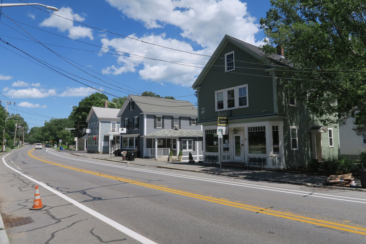
Wenham real estate includes First Period houses from the 1600s. The Claflin-Richards House dates to the late 1600s, and several other houses keep 17th-century sections. Center-chimney Colonials, a few Federal homes, Greek Revival and Italianate houses, and Gothic cottages from the mid-1800s line Main Street and the older side streets, including Cherry Street, Larch Row, Dodge Row, Arbor Street, and Cedar Street.
The Wenham Historic District covers both sides of Main Street from the Beverly line to the Hamilton line. It was listed on the National Register in 1973 and is also a local historic district, adopted in 1972, where a commission reviews new construction and exterior changes. Homes went up along Route 1A and the rural roads through the early 1900s, and after the 1940s more were built near Cherry Street and on former farmland. Areas include the Village Center, Main Street, Cherry Street, Larch Row, and the east end near Gordon College.
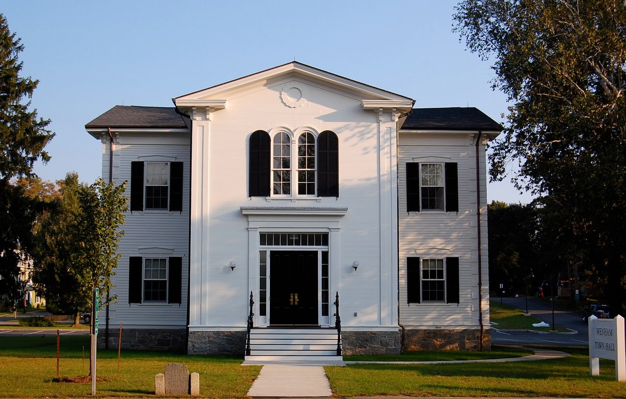
The village center on Main Street has the 1854 Town Hall, the Common, the Congregational Church, and the Wenham Museum, known for its dolls, toys, and model trains and home to the Claflin-Richards House. Pingree Park has a playground, Iron Rail on Rubbly Road has soccer fields and a walking path, and Tendercrop Farm sits along Main Street. Wenham shares a public library, a recreation department, and the Community House with Hamilton.
The southern end of Mass Audubon's Ipswich River Wildlife Sanctuary reaches into western Wenham, and the Great Wenham Swamp is the largest undeveloped tract in town. Wenham Lake, a reservoir for Salem and Beverly, is closed to the public but visible from Route 1A and Cedar Street. Gordon College, founded in 1889, has its campus in the east end of town.
What kinds of homes are in Wenham?
Wenham has First Period houses from the late 1600s, Colonial, Greek Revival, and Italianate homes along historic Main Street and its side streets, early 1900s houses on the rural roads, and homes from the 1940s on built near Cherry Street and on former farmland.
How do you get to Boston from Wenham?
Hamilton/Wenham station and North Beverly station, both on the MBTA Newburyport/Rockport Line, have direct trains to North Station. By car, Route 1A heads south through Beverly, and Route 128 has an exit at Grapevine Road.
Is Main Street in Wenham a historic district?
Yes. The Wenham Historic District covers both sides of Main Street from the Beverly line to the Hamilton line. It is listed on the National Register and is also a local historic district, so new construction and exterior changes are reviewed by the town's Historic District Commission.
To see homes for sale in Wenham, browse the listings below. Thinking of buying or selling in Wenham? Call (617) 848-9616 or get a free home valuation. Wenham is part of our North of Boston guide.
Photos: John Phelan, CC BY-SA 4.0 and Fletcher6, CC BY-SA 3.0, via Wikimedia Commons.
4,698 people live in Wenham, where the median age is 37 and the average individual income is $66,788. Data provided by the U.S. Census Bureau.
Total Population
Median Age
Population Density Population Density This is the number of people per square mile in a neighborhood.
Average individual Income
There's plenty to do around Wenham, including shopping, dining, nightlife, parks, and more. Data provided by Walk Score and Yelp.
Explore popular things to do in the area, including J G PT, and Sports Stop.
| Name | Category | Distance | Reviews |
Ratings by
Yelp
|
|---|---|---|---|---|
| Active | 0.39 miles | 0 reviews | 0/5 stars | |
| Active | 0.47 miles | 29 reviews | 3.8/5 stars | |
|
|
||||
|
|
||||
|
|
||||
|
|
||||
|
|
||||
|
|
Wenham has 1,223 households, with an average household size of 3. Data provided by the U.S. Census Bureau. Here’s what the people living in Wenham do for work — and how long it takes them to get there. Data provided by the U.S. Census Bureau. 4,698 people call Wenham home. The population density is 3,500 and the largest age group is Data provided by the U.S. Census Bureau.
Total Population
Population Density Population Density This is the number of people per square mile in a neighborhood.
Median Age
Men vs Women
Population by Age Group
0-9 Years
10-17 Years
18-24 Years
25-64 Years
65-74 Years
75+ Years
Education Level
Total Households
Average Household Size
Average individual Income
Households with Children
With Children:
Without Children:
Marital Status
Blue vs White Collar Workers
Blue Collar:
White Collar: