Framingham is a city in Middlesex County about 20 miles west of Boston, roughly halfway to Worcester. It pairs four historic centers, Framingham Centre, Saxonville, Nobscot, and downtown South Framingham, with a downtown commuter rail station, two Mass Pike exits, Lake Cochituate and Farm Pond, and woods and trails at Callahan State Park and Nobscot Hill.
Framingham is Nipmuc homeland, and the Old Connecticut Path, a Native trail, ran through the area. John Stone, the first English settler, arrived in the late 1640s on the Sudbury River at what is now Saxonville. From 1660 Thomas Danforth, a Massachusetts Bay official, received large land grants known as Danforth's Farms, and the town took its name from his hometown of Framlingham, England, with the L dropped. Framingham was incorporated in 1700, and its meetinghouse moved to the newly laid-out Common in 1735.
The Boston and Worcester Turnpike, today's Route 9, came through Framingham Centre in 1809, and the railroad reached South Framingham in 1834, which grew into a rail junction and the town's commercial center. Saxonville became a textile and carpet mill village, and South Framingham later became home to Dennison Manufacturing and a General Motors plant. The state Normal School moved to Framingham Centre in 1853 and is now Framingham State University, and Framingham became a city on January 1, 2018. Framingham borders Sudbury to the north, Wayland to the northeast, Natick to the east, Sherborn to the southeast, Ashland to the south, Southborough to the west, and Marlborough to the northwest.
Framingham station on Waverly Street downtown is on the MBTA Framingham/Worcester Line, with trains to Back Bay and South Station, and the MetroWest Regional Transit Authority runs local buses from the station area. The Mass Pike has two exits in the city, at Route 9 on the west side and Route 30 on the east side near Shoppers World. Route 9 crosses the city east and west through Framingham Centre, Route 126 runs north and south through Saxonville and downtown, and Routes 30 and 135 cross the city as well. The paved Cochituate Rail Trail runs about 3.7 miles from Saxonville past Lake Cochituate to Natick Center.
Framingham real estate ranges from colonial farmhouses to postwar neighborhoods and new downtown apartments. Center-chimney farmhouses from the 1700s survive around town, Federal and Italianate houses and 19th-century villas sit on the hills near Framingham Centre, and Saxonville keeps mill-worker houses, some from the 1820s. South Framingham has Queen Anne and Colonial Revival homes and many two-family houses from the early 1900s, and split-levels and ranches spread across the city after World War II. Apartment and condo complexes line Route 9 in West Framingham, and new apartment buildings have gone up downtown near the train.
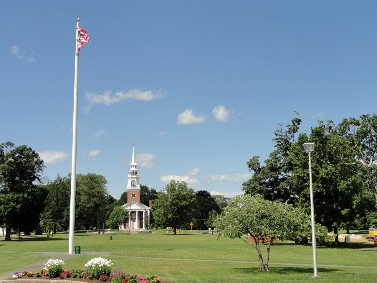
Framingham has 20 National Register listings, including the Framingham Centre Common, Saxonville, Concord Square, and Irving Square historic districts and H. H. Richardson's 1885 railroad depot, and the city's Historic District Commission reviews several local historic districts, among them Framingham Centre Common and the Jonathan Maynard district along Pleasant Street. Areas include Framingham Centre, Saxonville, Nobscot, downtown and South Framingham, and West Framingham along Route 9.
Callahan State Park, on the Marlborough line, has more than 800 acres and about seven miles of trails for hiking, horseback riding, and mountain biking, and Nobscot Hill next door has trails and the Tippling Rock viewpoint, with the Bay Circuit Trail passing through. Native Plant Trust runs Garden in the Woods, a native plant botanical garden on Hemenway Road, and the city manages beaches at Waushakum Pond, Learned Pond, and Saxonville Beach on Lake Cochituate. Cushing Memorial Park, on the site of a World War II Army hospital, has walking paths near Farm Pond.
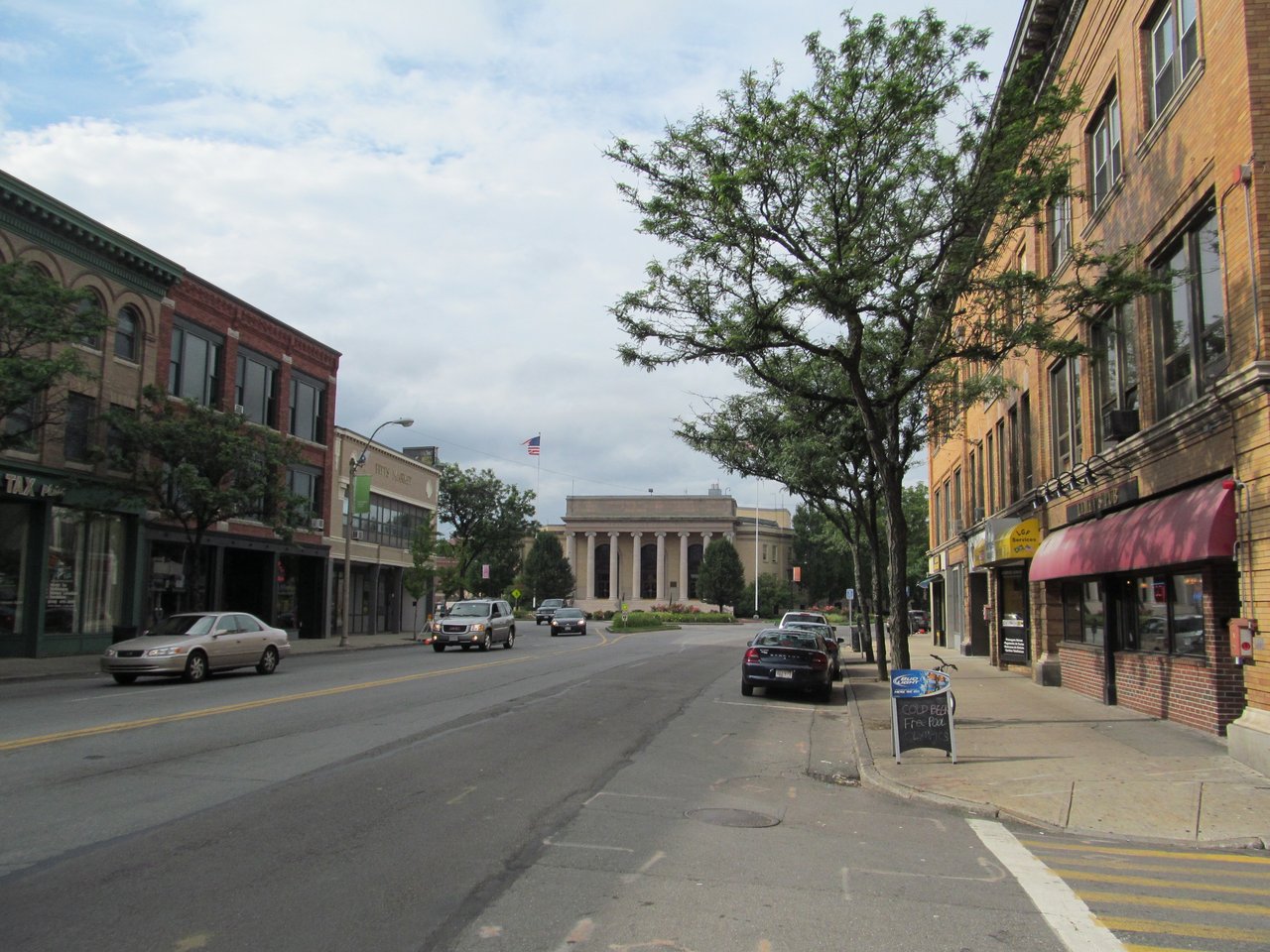
Around the Centre Common, the Framingham History Center runs the Edgell Memorial Library, the Old Academy, and Village Hall, and the Danforth Art Museum is part of Framingham State University. Downtown has the main public library, city hall, and many independent restaurants and shops, and the Golden Triangle along Route 9, shared with Natick, is a major regional shopping district. The Boston Marathon runs through downtown on Route 135 every Patriots' Day.
How do you get to Boston from Framingham?
Framingham station downtown is on the MBTA Framingham/Worcester Line, with trains to Back Bay and South Station. By car, the Mass Pike has two exits in the city and Route 9 heads east toward Boston.
What kinds of homes are in Framingham?
Framingham has colonial farmhouses, 19th-century homes near Framingham Centre and in Saxonville, early 1900s single- and two-family houses in South Framingham, postwar split-levels and ranches, and apartments and condos along Route 9 and downtown.
What are the villages of Framingham?
Framingham grew around four centers: Framingham Centre around the historic Common, the Saxonville mill village on the Sudbury River, Nobscot near Nobscot Hill, and downtown South Framingham near the train station.
To see homes for sale in Framingham, browse the listings below. Thinking of buying or selling in Framingham? Call (617) 848-9616 or get a free home valuation. Framingham is part of our MetroWest guide.
Photos: Daderot, public domain and John Phelan, CC BY-SA 3.0, via Wikimedia Commons.
72,399 people live in Framingham, where the median age is 37.5 and the average individual income is $53,991. Data provided by the U.S. Census Bureau.
Total Population
Median Age
Population Density Population Density This is the number of people per square mile in a neighborhood.
Average individual Income
There's plenty to do around Framingham, including shopping, dining, nightlife, parks, and more. Data provided by Walk Score and Yelp.
Explore popular things to do in the area, including Fresh City, All-Star Liquors, and Bakery Confectionry & Tbcco Lcl Wrkrs Un 348 Aflco.
| Name | Category | Distance | Reviews |
Ratings by
Yelp
|
|---|---|---|---|---|
| Dining · $ | 0.49 miles | 15 reviews | 1.9/5 stars | |
| Dining | 0.53 miles | 0 reviews | 0/5 stars | |
| Dining | 0.54 miles | 0 reviews | 0/5 stars | |
| Dining | 0.62 miles | 0 reviews | 0/5 stars | |
| Dining | 0.9 miles | 12 reviews | 3.3/5 stars | |
| Dining · $$ | 0.95 miles | 40 reviews | 2/5 stars | |
| Shopping | 0.62 miles | 0 reviews | 0/5 stars | |
| Active | 0.78 miles | 2 reviews | 5/5 stars | |
| Active | 0.81 miles | 0 reviews | 0/5 stars | |
| Active | 0.94 miles | 0 reviews | 0/5 stars | |
| Active | 0.96 miles | 0 reviews | 0/5 stars | |
| Nightlife | 0.91 miles | 2 reviews | 5/5 stars | |
| Beauty | 0.45 miles | 0 reviews | 0/5 stars | |
| Beauty | 0.54 miles | 0 reviews | 0/5 stars | |
| Beauty | 0.54 miles | 0 reviews | 0/5 stars | |
| Beauty | 0.54 miles | 10 reviews | 3.9/5 stars | |
| Beauty | 0.56 miles | 0 reviews | 0/5 stars | |
| Beauty | 0.56 miles | 0 reviews | 0/5 stars | |
| Beauty | 0.56 miles | 40 reviews | 2.7/5 stars | |
| Beauty | 0.62 miles | 1 review | 5/5 stars | |
| Beauty | 0.62 miles | 0 reviews | 0/5 stars | |
| Beauty | 0.62 miles | 0 reviews | 0/5 stars | |
| Beauty | 0.93 miles | 0 reviews | 0/5 stars | |
| Beauty | 0.94 miles | 37 reviews | 3.9/5 stars | |
|
|
||||
|
|
||||
|
|
||||
|
|
||||
|
|
||||
|
|
Framingham has 26,803 households, with an average household size of 2.58. Data provided by the U.S. Census Bureau. Here’s what the people living in Framingham do for work — and how long it takes them to get there. Data provided by the U.S. Census Bureau. 72,399 people call Framingham home. The population density is 2,891 and the largest age group is Data provided by the U.S. Census Bureau.
Total Population
Population Density Population Density This is the number of people per square mile in a neighborhood.
Median Age
Men vs Women
Population by Age Group
0-9 Years
10-17 Years
18-24 Years
25-64 Years
65-74 Years
75+ Years
Education Level
Total Households
Average Household Size
Average individual Income
Households with Children
With Children:
Without Children:
Marital Status
Blue vs White Collar Workers
Blue Collar:
White Collar: