Sherborn is a town in Middlesex County about 18 miles southwest of Boston, in the MetroWest region. It pairs a historic town center around the green and a long stretch of 18th- and early 19th-century houses on North Main Street with Farm Pond, the Charles River along its southeast edge, Rocky Narrows, the Sherborn Town Forest, and working farms and orchards.
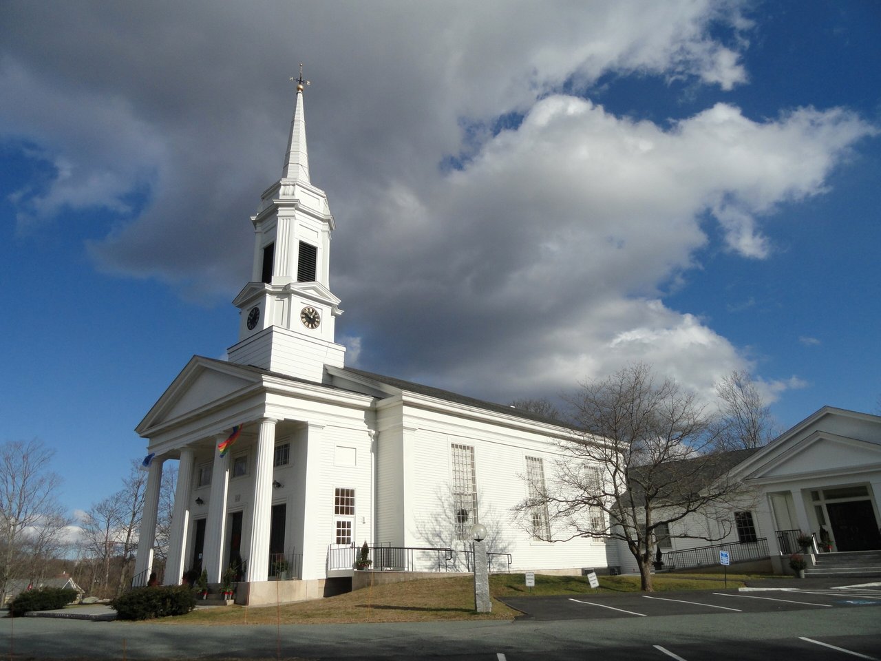
The Charles River valley here was known as Boggestow, and stone tools have been found at Rocky Narrows and near Farm Pond. The General Court made large land grants in the 1640s, and the first settlers bought land along the river in 1652. Sherborn was incorporated in 1674, and most of today's town came from an exchange of 4,000 acres with the Native community of Natick around 1680. Its first meetinghouse went up in the mid-1680s, and the current First Parish Church on the town green was built in 1830.
Sherborn lost land when Framingham formed in 1700 and Holliston split off in 1724. With little water power, it stayed a farming town, known for apples and cider mills, with cottage trades along North Main Street and cranberry bogs and dairies in the late 1800s. In the early 1900s country estates went up, many along the Charles, and after World War II new subdivisions spread on one- to three-acre lots. Sherborn borders Framingham and Natick to the north, Dover to the east, Medfield and Millis to the south, and Holliston and Ashland to the west.
Sherborn has no train station or MBTA bus service. The nearest commuter rail stations are in Natick and Framingham, on the Framingham/Worcester Line to Back Bay and South Station. Route 27 and Route 16 cross town and meet in the town center, with Route 27 running north to Natick and south to Medfield and Route 16 running east into South Natick and west toward I-495. The Mass Pike and Route 9 are reached through Framingham or Natick, and the Bay Circuit Trail crosses town through the Town Forest and Rocky Narrows.
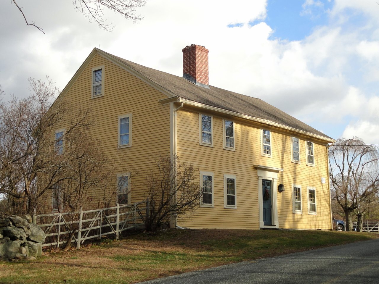
Sherborn real estate ranges from houses with late-1600s sections to postwar homes on large lots. Many 18th- and early 19th-century houses survive, including center-chimney colonials and Federal houses, along with Greek Revival and Italianate homes, Colonial and Federal Revival country houses from the early 1900s, and subdivisions built after World War II. Residential zoning sets minimum lots of one, two, and three acres, plus a six-acre district, and nearly all homes use private wells and septic systems.
Two National Register districts listed in 1986, Sherborn Center and Edward's Plain-Dowse's Corner along North Main Street, cover the historic core, and more than 20 houses are individually listed. The Sherborn Center Local Historic District, established in 1983, is reviewed by the town's Historic District Commission. Areas include Sherborn Center, North Main Street and Dowse's Corner, Brush Hill, and the river side of town near Rocky Narrows.
Farm Pond is the town's swimming spot, with a lifeguarded beach in season and a ramp for non-motorized boats. The Sherborn Town Forest covers about 560 acres in a belt from the Charles River to near the Framingham line, with trails for walking and riding and King Philip's Overlook. Rocky Narrows, The Trustees' first reservation, protects granite cliffs on the Charles known as the Gates of the Charles, with miles of trails and a canoe landing.
In the town center, the 1858 Town House is now the Community Center, the Sherborn Historical Society keeps a museum at the town offices, and the Sherborn Library is on Sanger Street. Farms, orchards, and stone-walled roads still shape much of the town, and Rocky Woods in Medfield is nearby.
Does Sherborn have town water and sewer?
Nearly all Sherborn homes use private wells and septic systems. Buyers should confirm the water and septic setup for any specific home.
How do you get to Boston from Sherborn?
Sherborn has no train station, but Framingham/Worcester Line stations in Natick and Framingham are a short drive away. By car, Route 27 and Route 16 lead to Route 9 and the Mass Pike.
What is Rocky Narrows?
Rocky Narrows is a reservation on the Charles River in Sherborn, run by The Trustees, with granite cliffs known as the Gates of the Charles, trails, and a canoe landing. It was The Trustees' first reservation, with land first deeded in 1897.
To see homes for sale in Sherborn, browse the listings below. Thinking of buying or selling in Sherborn? Call (617) 848-9616 or get a free home valuation. Sherborn is part of our MetroWest guide.
Photos: Daderot, CC0, via Wikimedia Commons.
4,427 people live in Sherborn, where the median age is 43 and the average individual income is $114,087. Data provided by the U.S. Census Bureau.
Total Population
Median Age
Population Density Population Density This is the number of people per square mile in a neighborhood.
Average individual Income
There's plenty to do around Sherborn, including shopping, dining, nightlife, parks, and more. Data provided by Walk Score and Yelp.
Explore popular things to do in the area, including Onebitesweet, Sherborn Blueberries, and Onebitesweet.
| Name | Category | Distance | Reviews |
Ratings by
Yelp
|
|---|---|---|---|---|
| Dining | 0.68 miles | 0 reviews | 0/5 stars | |
| Dining | 2.17 miles | 0 reviews | 0/5 stars | |
| Active | 0.87 miles | 1 review | 5/5 stars | |
| Active | 1.6 miles | 0 reviews | 0/5 stars | |
| Beauty | 0.5 miles | 0 reviews | 0/5 stars | |
| Beauty | 1.46 miles | 3 reviews | 5/5 stars | |
|
|
||||
|
|
||||
|
|
||||
|
|
||||
|
|
||||
|
|
Sherborn has 1,532 households, with an average household size of 3. Data provided by the U.S. Census Bureau. Here’s what the people living in Sherborn do for work — and how long it takes them to get there. Data provided by the U.S. Census Bureau. 4,427 people call Sherborn home. The population density is 275 and the largest age group is Data provided by the U.S. Census Bureau.
Total Population
Population Density Population Density This is the number of people per square mile in a neighborhood.
Median Age
Men vs Women
Population by Age Group
0-9 Years
10-17 Years
18-24 Years
25-64 Years
65-74 Years
75+ Years
Education Level
Total Households
Average Household Size
Average individual Income
Households with Children
With Children:
Without Children:
Marital Status
Blue vs White Collar Workers
Blue Collar:
White Collar: