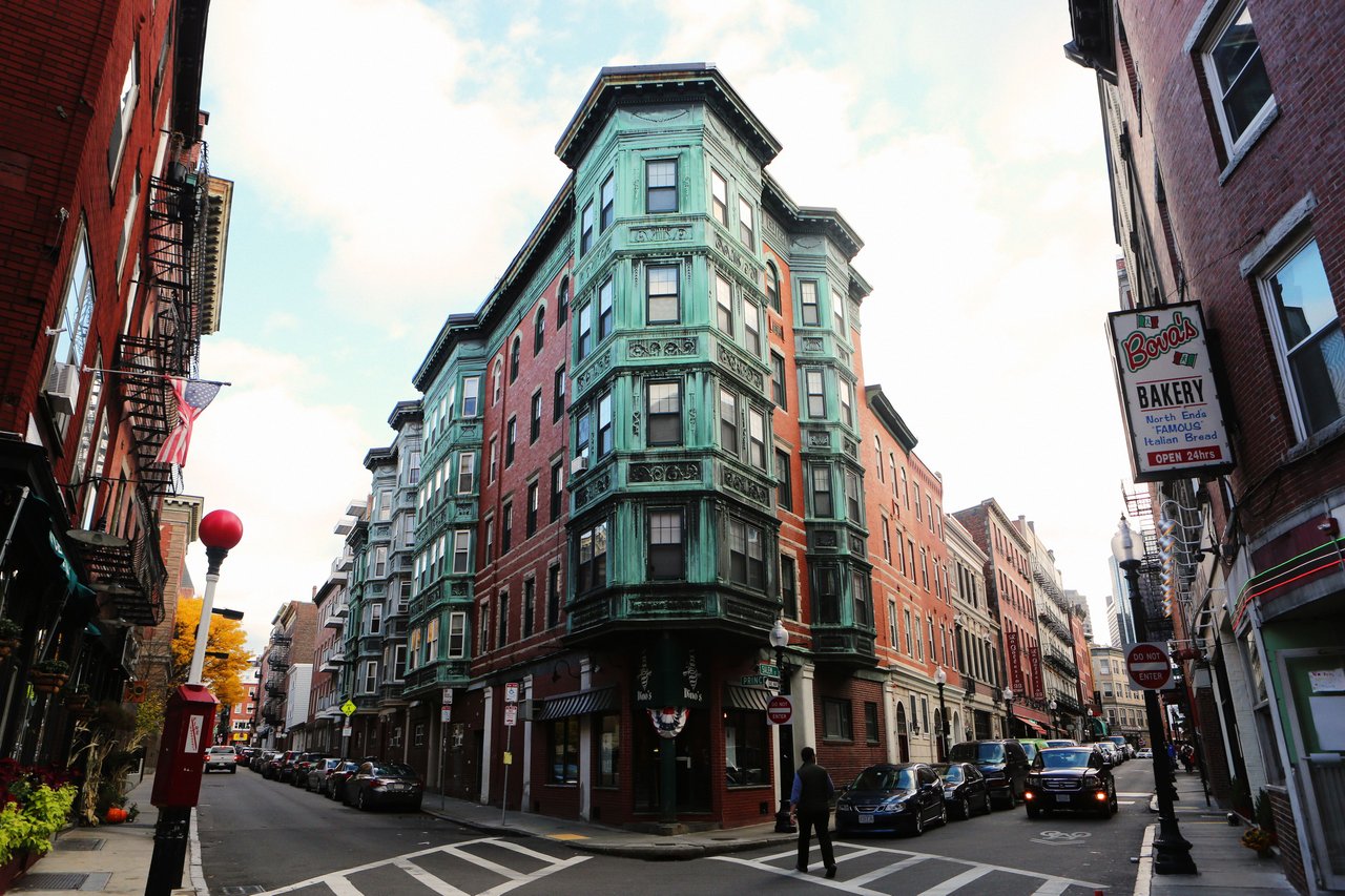
The North End is Boston's oldest residential neighborhood, a compact district of narrow streets on the city's northeastern waterfront, surrounded on two sides by Boston Harbor and separated from downtown by the Rose Kennedy Greenway. It is known for its colonial landmarks and the restaurants, bakeries, and cafes of Hanover and Salem Streets.
Europeans settled the North End in the early 17th century, and its street pattern still reflects that early town.
Much of Boston's colonial history survives here. The Paul Revere House on North Square, built about 1680, is the oldest building in downtown Boston and a National Historic Landmark. Old North Church on Salem Street, built in 1723, is the city's oldest standing church building, where two lanterns were hung on April 18, 1775. Copp's Hill Burying Ground, laid out in 1659, sits on the high ground overlooking the harbor and Charlestown. All three are stops on the Freedom Trail.
Haymarket station on the Orange and Green Lines sits at the neighborhood's edge, North Station adds commuter rail service a short walk away, and Aquarium station on the Blue Line serves the waterfront side. The Financial District, Faneuil Hall, and Government Center are a few minutes on foot across the Greenway, and most daily errands can be done without a car.
Most North End homes are condominiums in older brick walk-up buildings, many with shops or restaurants at street level and apartments above. Layouts tend to be efficient, and private outdoor space usually means a roof deck. Along Commercial Street and the harbor, historic granite warehouses and newer wharf buildings offer larger homes, water views, and in some cases garage parking, which is rare in the rest of the neighborhood.
North End buildings on our site include 44 Prince Street, a 55-unit condominium completed in 2005 with a garage below. The wharf buildings on the water side of Commercial Street, including Union Wharf, Lewis Wharf, Battery Wharf, Burroughs Wharf and The Mariner, are covered on our Waterfront page.
Daily life happens on foot. Hanover Street is lined with restaurants, pastry shops, and espresso bars, while Salem Street mixes markets and cafes. The Paul Revere Mall, a brick walkway laid out in 1933, links Old North Church with St. Stephen's Church, and Langone Park and Puopolo Playground sit right on the harbor along Commercial Street. Christopher Columbus Waterfront Park and the Harborwalk are close by.
Summer brings the neighborhood's religious feasts, including Saint Anthony's Feast at the end of August, organized by a society founded in 1919, with processions and food along the streets. The West End, Downtown, the Financial District, and Charlestown across the harbor are all close at hand.
What kinds of homes are in the North End?
Most homes are condominiums in older brick walk-up buildings, many with shops or restaurants at street level, and private outdoor space usually means a roof deck. Along Commercial Street and the harbor, granite warehouses and newer wharf buildings offer larger homes, water views and in some cases garage parking.
How do you get around from the North End?
Haymarket station on the Orange and Green Lines sits at the neighborhood's edge, North Station adds commuter rail a short walk away, and Aquarium station on the Blue Line serves the waterfront side. The Financial District, Faneuil Hall and Government Center are a few minutes on foot across the Greenway.
What historic sites are in the North End?
The Paul Revere House, built about 1680, is the oldest building in downtown Boston, and Old North Church, built in 1723, is the city's oldest standing church building. Copp's Hill Burying Ground, laid out in 1659, overlooks the harbor, and all three are stops on the Freedom Trail.
To see homes for sale in the North End, browse the listings below. Thinking of buying or selling in the North End? Call (617) 848-9616 or get a free home valuation. The North End is part of our Boston neighborhood guide.
9,436 people live in North End, where the median age is 32 and the average individual income is $92,501. Data provided by the U.S. Census Bureau.
Total Population
Median Age
Population Density Population Density This is the number of people per square mile in a neighborhood.
Average individual Income
There's plenty to do around North End, including shopping, dining, nightlife, parks, and more. Data provided by Walk Score and Yelp.
Explore popular things to do in the area, including The Flying Chicken, Shannon McNally Wellness, and Warren Witherstine Square.
| Name | Category | Distance | Reviews |
Ratings by
Yelp
|
|---|---|---|---|---|
| Dining | 0.16 miles | 0 reviews | 0/5 stars | |
| Active | 0.14 miles | 0 reviews | 0/5 stars | |
| Active | 0.16 miles | 0 reviews | 0/5 stars | |
| Active | 0.22 miles | 0 reviews | 0/5 stars | |
| Nightlife | 0.16 miles | 0 reviews | 0/5 stars | |
| Beauty | 0.07 miles | 0 reviews | 0/5 stars | |
|
|
||||
|
|
||||
|
|
||||
|
|
||||
|
|
||||
|
|
North End has 5,775 households, with an average household size of 2. Data provided by the U.S. Census Bureau. Here’s what the people living in North End do for work — and how long it takes them to get there. Data provided by the U.S. Census Bureau. 9,436 people call North End home. The population density is 61,298 and the largest age group is Data provided by the U.S. Census Bureau.
Total Population
Population Density Population Density This is the number of people per square mile in a neighborhood.
Median Age
Men vs Women
Population by Age Group
0-9 Years
10-17 Years
18-24 Years
25-64 Years
65-74 Years
75+ Years
Education Level
Total Households
Average Household Size
Average individual Income
Households with Children
With Children:
Without Children:
Marital Status
Blue vs White Collar Workers
Blue Collar:
White Collar: