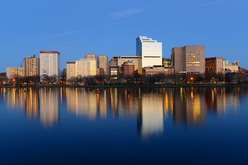
The West End is a downtown Boston neighborhood on the Charles River, stretching from Cambridge Street and the foot of Beacon Hill north to the river and east to North Station. It is home to Massachusetts General Hospital, TD Garden, and the Museum of Science, along with high-rise residential towers and converted loft buildings around North Station.
The neighborhood's history is one of the most dramatic in Boston. Farmland in the 1700s, it became a fashionable enclave in the 1790s, when Charles Bulfinch designed mansions here, including the 1796 Otis House on Cambridge Street. By the early 1900s it was a crowded neighborhood. Old West Church, built in 1806 to a design by Asher Benjamin, still stands on Cambridge Street, and Massachusetts General Hospital's Ether Dome is a National Historic Landmark.
In the late 1950s the city cleared the neighborhood's residential core under urban renewal, displacing more than 12,000 residents. Charles River Park, a modernist complex of towers set in landscaped grounds, rose in its place in the 1960s. The West End Museum now tells the story of the old neighborhood. To the east, the Bulfinch Triangle, built on land created by filling the Mill Pond between 1807 and 1832, kept its 19th-century commercial blocks and is now a historic district.
Few Boston neighborhoods have more transit. North Station serves the Orange and Green Lines and commuter rail, Charles/MGH is on the Red Line, Bowdoin is on the Blue Line, and Science Park/West End is on the Green Line. Storrow Drive and I-93 run along the edges, and Cambridge is across the river.
West End housing falls into two groups. Charles River Park's 1960s towers near the hospital include large condominium buildings with river and skyline views, while the blocks around North Station mix converted brick warehouses with newer full-service buildings. Nearly everything here is a condominium or apartment in a mid-rise or high-rise building, often with concierge service and garage parking.
West End buildings on our site include:
The Charles River shapes daily life here. The Esplanade's paths begin at the neighborhood's edge, and the New Charles River Basin parks, including Nashua Street Park and Paul Revere Park, line the water near the Museum of Science. TD Garden hosts the Celtics, the Bruins, and major concerts, and the Boston Public Market and Haymarket are a short walk east.
Charles Street and Beacon Hill are just across Cambridge Street, the North End is a few blocks east, and Downtown and Cambridge are close by.
What kinds of homes are in the West End?
Nearly everything is a condominium or apartment in a mid-rise or high-rise building, often with concierge service and garage parking. Charles River Park's 1960s towers near the hospital include large condominium buildings with river and skyline views, while the blocks around North Station mix converted brick warehouses with newer full-service buildings.
How do you get around from the West End?
North Station serves the Orange and Green Lines and commuter rail, Charles/MGH is on the Red Line, Bowdoin is on the Blue Line, and Science Park/West End is on the Green Line. Storrow Drive and I-93 run along the edges.
What is the Bulfinch Triangle?
The Bulfinch Triangle, on the eastern side of the West End, was built on land created by filling the Mill Pond between 1807 and 1832. It kept its 19th-century commercial blocks and is now a historic district.
To see homes for sale in the West End, browse the listings below. Thinking of buying or selling in the West End? Call (617) 848-9616 or get a free home valuation. The West End is part of our Boston neighborhood guide.
8,249 people live in West End, where the median age is 32 and the average individual income is $106,681. Data provided by the U.S. Census Bureau.
Total Population
Median Age
Population Density Population Density This is the number of people per square mile in a neighborhood.
Average individual Income
There's plenty to do around West End, including shopping, dining, nightlife, parks, and more. Data provided by Walk Score and Yelp.
Explore popular things to do in the area, including Kradin Richard MD, Harris Wm H MD & Assocs, and Chueh Henry MD.
| Name | Category | Distance | Reviews |
Ratings by
Yelp
|
|---|---|---|---|---|
| Active | 0.09 miles | 0 reviews | 0/5 stars | |
| Active | 0.18 miles | 0 reviews | 0/5 stars | |
| Active | 0.18 miles | 0 reviews | 0/5 stars | |
| Active | 0.18 miles | 0 reviews | 0/5 stars | |
| Active | 0.19 miles | 0 reviews | 0/5 stars | |
| Active | 0.2 miles | 0 reviews | 0/5 stars | |
| Active | 0.22 miles | 0 reviews | 0/5 stars | |
| Active | 0.25 miles | 2 reviews | 5/5 stars | |
| Active | 0.26 miles | 1 review | 5/5 stars | |
| Active | 0.26 miles | 0 reviews | 0/5 stars | |
| Active | 0.46 miles | 0 reviews | 0/5 stars | |
| Beauty | 0.14 miles | 0 reviews | 0/5 stars | |
| Beauty | 0.31 miles | 154 reviews | 3.8/5 stars | |
|
|
||||
|
|
||||
|
|
||||
|
|
||||
|
|
||||
|
|
West End has 4,490 households, with an average household size of 2. Data provided by the U.S. Census Bureau. Here’s what the people living in West End do for work — and how long it takes them to get there. Data provided by the U.S. Census Bureau. 8,249 people call West End home. The population density is 44,025 and the largest age group is Data provided by the U.S. Census Bureau.
Total Population
Population Density Population Density This is the number of people per square mile in a neighborhood.
Median Age
Men vs Women
Population by Age Group
0-9 Years
10-17 Years
18-24 Years
25-64 Years
65-74 Years
75+ Years
Education Level
Total Households
Average Household Size
Average individual Income
Households with Children
With Children:
Without Children:
Marital Status
Blue vs White Collar Workers
Blue Collar:
White Collar: