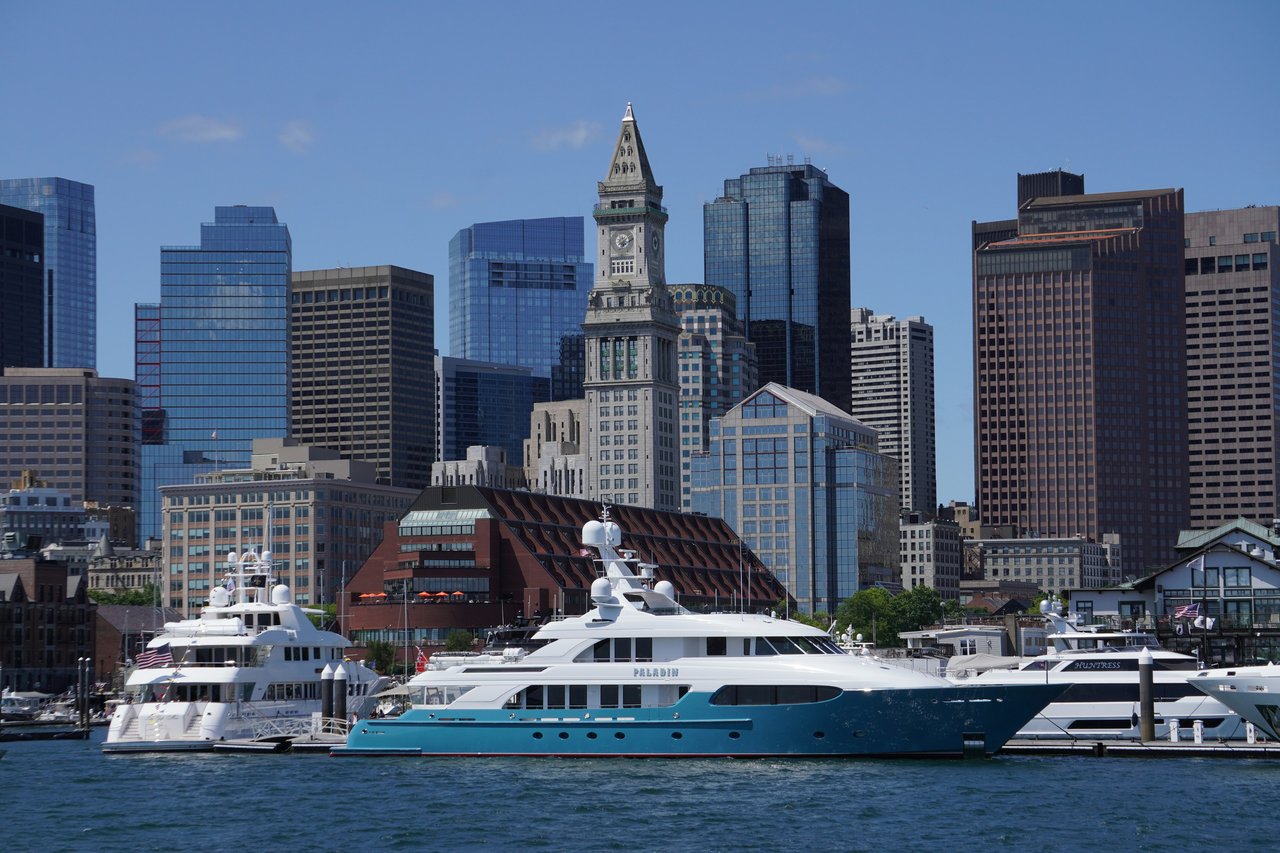
Boston's Waterfront is the string of historic wharves along the downtown and North End edge of Boston Harbor, running from Battery Wharf in the North End south past Long Wharf and Rowes Wharf toward Fort Point Channel. It is separate from the Seaport across the channel, and its homes range from 19th-century granite warehouses to full-service towers, nearly all within steps of the water.
For two centuries this was the working heart of Boston's port. Long Wharf, built around 1710 to 1721 at the foot of what is now State Street, reached half a mile into the harbor and anchored the town's trade. Merchants lined the shore with wharves and warehouses, many built of Quincy granite in the 1830s and 1840s. Atlantic Avenue was cut across the wharves in the late 1860s, and as shipping moved elsewhere in the 20th century the buildings sat underused, cut off from the city by the elevated Central Artery.
Renewal began in the 1960s and 1970s. Warehouses on Commercial, Lewis, and Union Wharves were converted to homes, the New England Aquarium opened on Central Wharf in 1969, Harbor Towers rose in 1971 as the first major residential buildings on the waterfront, and Christopher Columbus Waterfront Park opened in 1976. Rowes Wharf followed in 1987. When the Big Dig replaced the elevated highway, the Rose Kennedy Greenway opened in 2008 and reconnected the wharves to downtown. The City of Boston refers to much of this area as the Wharf District.
Aquarium station on the Blue Line sits at State Street and Atlantic Avenue, with Haymarket and State a short walk inland and South Station within reach of the southern wharves. Boston Harbor Islands ferries leave from Long Wharf, MBTA ferries stop at Rowes Wharf, and water taxis serve several docks. I-93 runs beneath the Greenway.
Waterfront homes are almost all condominiums. Converted granite and brick warehouses offer exposed beams, brick walls, and deep-set windows, while later buildings add concierge service, garage parking, and in some cases hotel services and marina slips.
Waterfront buildings on our site include:
The Harborwalk runs along the wharves, connecting parks, piers, and marinas. Christopher Columbus Waterfront Park, opened in 1976 on filled land at the harbor's edge, sits between Commercial and Long Wharves, and the Greenway's gardens, fountains, and seasonal markets are across Atlantic Avenue. The New England Aquarium, harbor cruises, and island ferries are part of everyday scenery.
The North End's restaurants are a short walk away, the Financial District and Faneuil Hall are just inland, and the Seaport and Fort Point are across the channel.
What kinds of homes are on the Waterfront?
Waterfront homes are almost all condominiums. Converted granite and brick warehouses offer exposed beams, brick walls and deep-set windows, while later buildings add concierge service, garage parking, and in some cases hotel services and marina slips.
How do you get around from the Waterfront?
Aquarium station on the Blue Line sits at State Street and Atlantic Avenue, with Haymarket and State a short walk inland and South Station within reach of the southern wharves. MBTA ferries stop at Rowes Wharf, Boston Harbor Islands ferries leave from Long Wharf, and water taxis serve several docks.
Is the Waterfront the same as the Seaport?
No. The Waterfront is the string of historic wharves along the downtown and North End edge of Boston Harbor, from Battery Wharf south past Long Wharf and Rowes Wharf toward Fort Point Channel. The Seaport is across the channel, and the City of Boston refers to much of the Waterfront as the Wharf District.
To see homes for sale in Waterfront, browse the listings below. Thinking of buying or selling in Waterfront? Call (617) 848-9616 or get a free home valuation. Waterfront is part of our Boston neighborhood guide.
4,677 people live in Waterfront, where the median age is 45 and the average individual income is $143,236. Data provided by the U.S. Census Bureau.
Total Population
Median Age
Population Density Population Density This is the number of people per square mile in a neighborhood.
Average individual Income
There's plenty to do around Waterfront, including shopping, dining, nightlife, parks, and more. Data provided by Walk Score and Yelp.
Explore popular things to do in the area, including The Flying Chicken, Warren Witherstine Square, and Two if by Sea.
| Name | Category | Distance | Reviews |
Ratings by
Yelp
|
|---|---|---|---|---|
| Dining | 0.09 miles | 0 reviews | 0/5 stars | |
| Active | 0.09 miles | 0 reviews | 0/5 stars | |
| Nightlife | 0.36 miles | 0 reviews | 0/5 stars | |
| Beauty | 0.08 miles | 0 reviews | 0/5 stars | |
|
|
||||
|
|
||||
|
|
||||
|
|
||||
|
|
||||
|
|
Waterfront has 2,665 households, with an average household size of 2. Data provided by the U.S. Census Bureau. Here’s what the people living in Waterfront do for work — and how long it takes them to get there. Data provided by the U.S. Census Bureau. 4,677 people call Waterfront home. The population density is 68,892 and the largest age group is Data provided by the U.S. Census Bureau.
Total Population
Population Density Population Density This is the number of people per square mile in a neighborhood.
Median Age
Men vs Women
Population by Age Group
0-9 Years
10-17 Years
18-24 Years
25-64 Years
65-74 Years
75+ Years
Education Level
Total Households
Average Household Size
Average individual Income
Households with Children
With Children:
Without Children:
Marital Status
Blue vs White Collar Workers
Blue Collar:
White Collar: