Quincy is a coastal city directly south of Boston across the Neponset River, known as the City of Presidents for the birthplace of Presidents John Adams and John Quincy Adams. With four Red Line stations, miles of shoreline on Quincy Bay, and neighborhoods from Squantum and Marina Bay to Wollaston, Houghs Neck, and West Quincy, it offers everything from 18th-century houses to waterfront condominiums.
English settlement here dates to the 1620s at Mount Wollaston, a name still carried by the Wollaston neighborhood. The area later became part of Braintree, and in 1792 it was incorporated as the separate town of Quincy, named for Colonel John Quincy, grandfather of Abigail Adams. Quincy became a city in 1888.
Granite shaped the city. In 1826 the Granite Railway, one of the first railroads in the country, carried stone from the West Quincy quarries toward the Neponset River for the Bunker Hill Monument, and more than 40 quarries operated here at one time. The Old Colony Railroad arrived in 1845 and began Quincy's growth as a suburb, and the Fore River Shipyard was the city's leading industry for most of the 20th century. Quincy borders Dorchester across the Neponset, Milton to the west, and Braintree, Randolph, and Weymouth to the south and east.
The Red Line stops at North Quincy, Wollaston, Quincy Center, and Quincy Adams. Quincy Center is also a commuter rail stop on the Greenbush, Kingston, and Fall River/New Bedford lines, with Greenbush trains continuing to Hingham. An MBTA ferry runs from Squantum Point to Central Wharf, Fan Pier in the Seaport District, and Logan Airport. Interstate 93 and Route 3A carry traffic north to Boston.
Quincy's housing spans more than two centuries. Early 19th-century center-chimney houses and the story-and-a-half Quincy Cottage, built in large numbers for quarry and shipyard workers, survive in the older sections, along with Stick Style and Queen Anne houses from the late 1800s. Two-family Colonial Revival and Craftsman houses were the most common homes built in the early 1900s, and the 1920s added Dutch Colonial, Tudor, and bungalow homes in Wollaston, Norfolk Downs, Germantown, and Houghs Neck.
Condominiums range from converted two-family houses to mid- and high-rise buildings in Quincy Center and North Quincy and along the water at Marina Bay, built on the site of the former Squantum Naval Air Station. Waterfront single-family homes line the shore in Squantum, Houghs Neck, and Merrymount.
Adams National Historical Park preserves the houses where John Adams and John Quincy Adams were born, the Old House at Peace field, home to four generations of Adamses, and its Stone Library. Both presidents are entombed at United First Parish Church in Quincy Center, and the nearby Thomas Crane Public Library was designed by H. H. Richardson in the early 1880s. Hancock Street is the main commercial street through Quincy Center and Wollaston.
The 2.3-mile beach along Quincy Shore Drive, including Wollaston Beach, is part of the state's Quincy Shores Reservation, with Caddy Park at its southern end and Moswetuset Hummock to the north. Marina Bay pairs a large marina with a waterfront boardwalk, and the Quincy Quarries Reservation, near the Blue Hills, offers trails past the old granite quarries.
What kinds of homes are in Quincy?
Quincy's housing spans more than two centuries, from early center-chimney houses and Quincy Cottages to two-family Colonial Revival and Craftsman houses and 1920s Dutch Colonial, Tudor and bungalow homes. Condominiums range from converted two-family houses to mid- and high-rise buildings in Quincy Center, North Quincy and Marina Bay.
How do you get to Boston from Quincy?
The Red Line stops at North Quincy, Wollaston, Quincy Center and Quincy Adams, and Quincy Center is also a commuter rail stop. An MBTA ferry runs from Squantum Point to Central Wharf, Fan Pier and Logan Airport, and Interstate 93 and Route 3A carry traffic north to Boston.
Where are Quincy's beaches?
The 2.3-mile beach along Quincy Shore Drive, including Wollaston Beach, is part of the state's Quincy Shores Reservation, with Caddy Park at its southern end and Moswetuset Hummock to the north. Waterfront single-family homes line the shore in Squantum, Houghs Neck and Merrymount.
To see homes for sale in Quincy, browse the listings below. Thinking of buying or selling in Quincy? Call (617) 848-9616 or get a free home valuation. Quincy is part of our South Shore guide.
102,114 people live in Quincy, where the median age is 38.6 and the average individual income is $54,982. Data provided by the U.S. Census Bureau.
Total Population
Median Age
Population Density Population Density This is the number of people per square mile in a neighborhood.
Average individual Income
There's plenty to do around Quincy, including shopping, dining, nightlife, parks, and more. Data provided by Walk Score and Yelp.
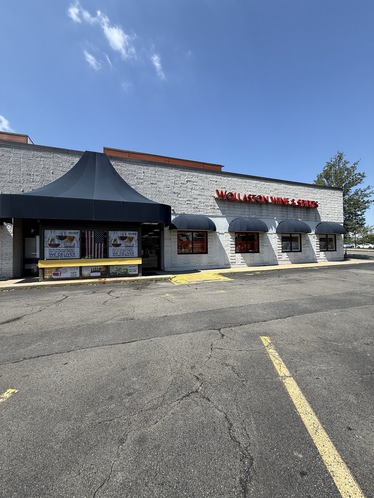
Explore popular things to do in the area, including Wollaston Wine & Spirits, Gooches Bakery, and Lazzarino's Gourmet Pizzerias.
| Name | Category | Distance | Reviews |
Ratings by
Yelp
|
|---|---|---|---|---|
| Dining · $$ | 0.62 miles | 57 reviews | 3.9/5 stars | |
| Dining | 0.74 miles | 0 reviews | 0/5 stars | |
| Dining | 0.76 miles | 1 review | 5/5 stars | |
| Dining | 0.93 miles | 0 reviews | 0/5 stars | |
| Dining | 0.93 miles | 1 review | 3/5 stars | |
| Dining | 0.97 miles | 0 reviews | 0/5 stars | |
| Dining · $ | 1.19 miles | 43 reviews | 3.5/5 stars | |
| Active | 0.36 miles | 0 reviews | 0/5 stars | |
| Active | 0.53 miles | 0 reviews | 0/5 stars | |
| Active | 0.53 miles | 0 reviews | 0/5 stars | |
| Active | 0.61 miles | 0 reviews | 0/5 stars | |
| Active | 0.65 miles | 0 reviews | 0/5 stars | |
| Active | 0.66 miles | 0 reviews | 0/5 stars | |
| Active | 0.87 miles | 0 reviews | 0/5 stars | |
| Active | 0.93 miles | 13 reviews | 1.8/5 stars | |
| Active | 1.02 miles | 0 reviews | 0/5 stars | |
| Beauty | 0.26 miles | 59 reviews | 2.7/5 stars | |
| Beauty | 0.38 miles | 17 reviews | 2.8/5 stars | |
| Beauty | 0.55 miles | 126 reviews | 4/5 stars | |
| Beauty | 0.62 miles | 43 reviews | 3.2/5 stars | |
| Beauty | 0.94 miles | 0 reviews | 0/5 stars | |
| Beauty | 0.96 miles | 0 reviews | 0/5 stars | |
| Beauty | 1.03 miles | 0 reviews | 0/5 stars | |
| Beauty | 1.07 miles | 7 reviews | 2.3/5 stars | |
|
|
||||
|
|
||||
|
|
||||
|
|
||||
|
|
||||
|
|
Quincy has 45,285 households, with an average household size of 2.22. Data provided by the U.S. Census Bureau. Here’s what the people living in Quincy do for work — and how long it takes them to get there. Data provided by the U.S. Census Bureau. 102,114 people call Quincy home. The population density is 6,162 and the largest age group is Data provided by the U.S. Census Bureau.
Total Population
Population Density Population Density This is the number of people per square mile in a neighborhood.
Median Age
Men vs Women
Population by Age Group
0-9 Years
10-17 Years
18-24 Years
25-64 Years
65-74 Years
75+ Years
Education Level
Total Households
Average Household Size
Average individual Income
Households with Children
With Children:
Without Children:
Marital Status
Blue vs White Collar Workers
Blue Collar:
White Collar: