Westwood is a town in Norfolk County about 12 miles southwest of Boston, where I-95/Route 128 meets the Providence corridor. It pairs a historic town center along High Street and the Islington village on Washington Street with University Station, two commuter rail stations including Amtrak service at Route 128, and more than 1,100 acres of trails at Hale on the Dover line.
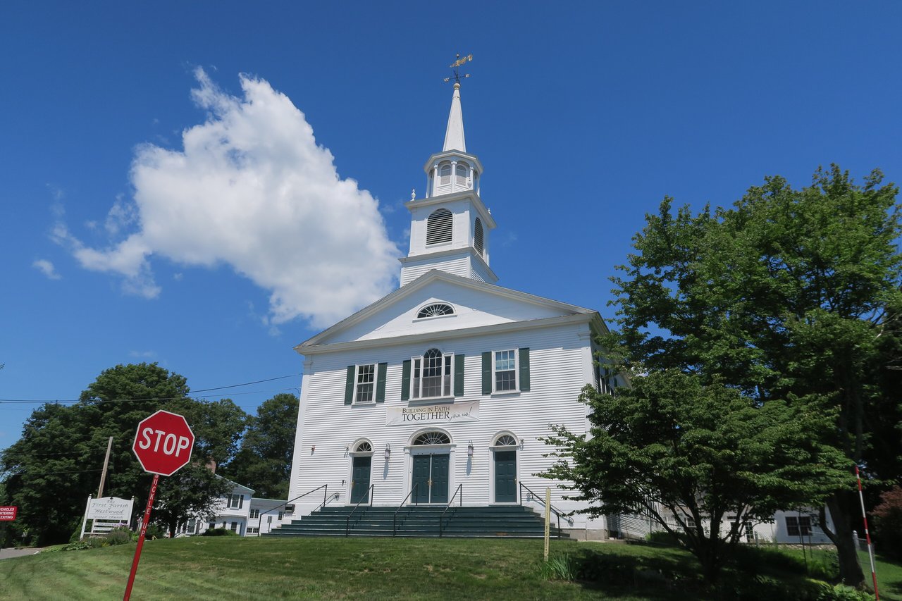
Westwood was part of the Dedham land grant of 1636, and farms spread across its hills in the late 1600s and 1700s. In 1737 it became the Third Precinct of Dedham and was long known as West Dedham. The First Parish meeting house on Nahatan Street went up in 1809, and in the 1880s the sale of Buckmaster Pond water rights to Norwood was one of the disputes that pushed West Dedham toward separation.
The town was incorporated on April 2, 1897. The first choice of name, Nahatan, was dropped after a legislator from Nahant objected, and Westwood was chosen instead. Around 1900 Bostonians built country estates on the hills, and Route 128 in the 1930s turned Westwood into a commuter town. Westwood borders Needham to the north, Dedham to the east, Canton to the southeast across the Neponset River, Norwood to the south, Walpole to the southwest, and Dover to the west.
Westwood has two commuter rail stations. Route 128 station on University Avenue is on the MBTA Providence/Stoughton Line to Back Bay and South Station, and it is also an Amtrak stop for Acela and Northeast Regional trains. Islington station on Carroll Avenue is on the Franklin/Foxboro Line to South Station. MBTA bus 34E runs along Washington Street to Forest Hills on the Orange Line. I-95/Route 128 crosses the east side of town, I-93 begins just over the line in Canton, and Route 109 follows High Street through the center toward Dedham and Medfield.
Westwood real estate is mostly single-family homes built in the 20th century, along with a few 18th-century farmhouses, Federal and Greek Revival houses, and Queen Anne and Colonial Revival homes from the late 1800s and early 1900s. Two National Register districts listed in 2000, the Colburn School-High Street and Fisher School-High Street districts, cover much of the historic streetscape along High Street.
University Station, built next to the Route 128 station beginning in 2013, added shops, restaurants, and apartments and condos within walking distance of the train. Areas include the town center along High Street, Islington around Washington Street and the Islington station, the Clapboardtrees area, and the neighborhoods near University Avenue.
Hale covers more than 1,100 acres of woods, ponds, and trails in Westwood and Dover. It is a private nonprofit, and a 2026 conservation restriction protects its trails for public use. Its trails connect to Noanet Woodlands and Powisset Farm in Dover. The Westwood Land Trust looks after other conservation land, and Buckmaster Pond is used for kayaking and fishing.
The main town library on High Street moved into its current building in 2013, and there is a branch in Islington. Westwood Day brings the town together each September, and University Station gives the east side of town shopping and dining near the highway.
How do you get to Boston from Westwood?
Route 128 station has MBTA Providence/Stoughton Line trains to Back Bay and South Station, plus Amtrak service. Islington station is on the Franklin/Foxboro Line to South Station. By car, I-95/Route 128 and I-93 are close by.
What kinds of homes are in Westwood?
Westwood is mostly single-family homes from the 20th century, with some 18th-century farmhouses, Federal and Greek Revival houses, and late 1800s Queen Anne and Colonial Revival homes, plus apartments and condos at University Station.
Why is it called Westwood?
West Dedham first planned to call itself Nahatan when it split from Dedham in 1897, but a legislator from Nahant objected to the similar name, so the town chose Westwood.
To see homes for sale in Westwood, browse the listings below. Thinking of buying or selling in Westwood? Call (617) 848-9616 or get a free home valuation. Westwood is part of our MetroWest guide.
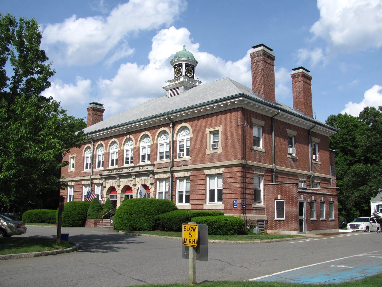
Photos: John Phelan, CC BY-SA 4.0 and John Phelan, CC BY 3.0, via Wikimedia Commons.
16,318 people live in Westwood, where the median age is 43 and the average individual income is $92,854. Data provided by the U.S. Census Bureau.
Total Population
Median Age
Population Density Population Density This is the number of people per square mile in a neighborhood.
Average individual Income
There's plenty to do around Westwood, including shopping, dining, nightlife, parks, and more. Data provided by Walk Score and Yelp.
Explore popular things to do in the area, including Shell, Taj India Bistro, and Westwood Recreation.
| Name | Category | Distance | Reviews |
Ratings by
Yelp
|
|---|---|---|---|---|
| Dining | 1.54 miles | 2 reviews | 3.5/5 stars | |
| Dining | 1.62 miles | 1 review | 4/5 stars | |
| Active | 0.38 miles | 0 reviews | 0/5 stars | |
| Active | 0.84 miles | 0 reviews | 0/5 stars | |
| Active | 0.84 miles | 0 reviews | 0/5 stars | |
| Active | 1.08 miles | 0 reviews | 0/5 stars | |
| Beauty | 0.7 miles | 13 reviews | 4.1/5 stars | |
| Beauty | 0.74 miles | 3 reviews | 3.7/5 stars | |
| Beauty | 0.78 miles | 1 review | 1/5 stars | |
| Beauty | 1.57 miles | 12 reviews | 4.1/5 stars | |
|
|
||||
|
|
||||
|
|
||||
|
|
||||
|
|
||||
|
|
Westwood has 5,592 households, with an average household size of 3. Data provided by the U.S. Census Bureau. Here’s what the people living in Westwood do for work — and how long it takes them to get there. Data provided by the U.S. Census Bureau. 16,318 people call Westwood home. The population density is 2,044 and the largest age group is Data provided by the U.S. Census Bureau.
Total Population
Population Density Population Density This is the number of people per square mile in a neighborhood.
Median Age
Men vs Women
Population by Age Group
0-9 Years
10-17 Years
18-24 Years
25-64 Years
65-74 Years
75+ Years
Education Level
Total Households
Average Household Size
Average individual Income
Households with Children
With Children:
Without Children:
Marital Status
Blue vs White Collar Workers
Blue Collar:
White Collar: