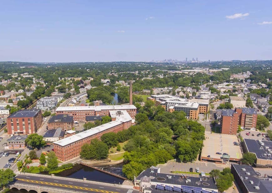
Waltham is a city in Middlesex County on the Charles River, west of Boston, known as the Watch City for the watch company that made its name famous. Its downtown, centered on Waltham Common at Main and Moody Streets, sits beside the river and the mill buildings where much of American manufacturing began.
Waltham was settled around 1634 as part of Watertown, set off as its own town in 1738, and incorporated as a city in 1884. Its industrial story starts in 1813, when Francis Cabot Lowell and the Boston Associates built the Boston Manufacturing Company on the Charles River, a mill that brought every step of making cotton cloth under one roof. The mill on Moody Street now houses the Charles River Museum of Industry and Innovation.
In 1854 the company that became the Waltham Watch Company arrived, and it went on to produce tens of millions of watches before closing in 1957. Its brick factory complex on Crescent Street is listed on the National Register of Historic Places as the American Waltham Watch Company Historic District. The city borders Watertown and Belmont to the east, Newton to the south, Weston and Lincoln to the west, and Lexington to the north.
The Fitchburg Line commuter rail stops at Waltham station near the center of the city and at Brandeis/Roberts station on the south side. MBTA bus route 70 connects Waltham Center with Watertown and Cambridge. Route 128 (I-95) runs along the city's western side, and Route 20 is the main east-west road through downtown. The Mass Central Rail Trail follows about four miles of former rail line across the city.
Waltham real estate covers a wide range. The blocks around Moody Street and the downtown hold older wood-frame single-family, two-family, and multi-family houses, many from the city's manufacturing years. Farther from the center, streets of Colonial, Cape, and later 20th-century single-family homes fill the city's hillier neighborhoods. Condominiums appear throughout, from converted houses to newer complexes, and former mill buildings along the river have been adapted for new uses. The Watch Factory on Crescent Street, for example, now combines offices, shops, and apartments inside the restored 19th-century complex.
Moody Street is the city's best-known dining street, with a long run of restaurants, cafes, and shops, and the Charles River Riverwalk is reached from several points along it. Waltham Common hosts outdoor concerts and events. Historic estates are a short drive away: Gore Place, the 1806 country house of Christopher and Rebecca Gore, keeps about 50 acres of open land and a working farm, and Stonehurst, the Robert Treat Paine Estate, is a National Historic Landmark designed by H.H. Richardson and Frederick Law Olmsted, now owned by the city.
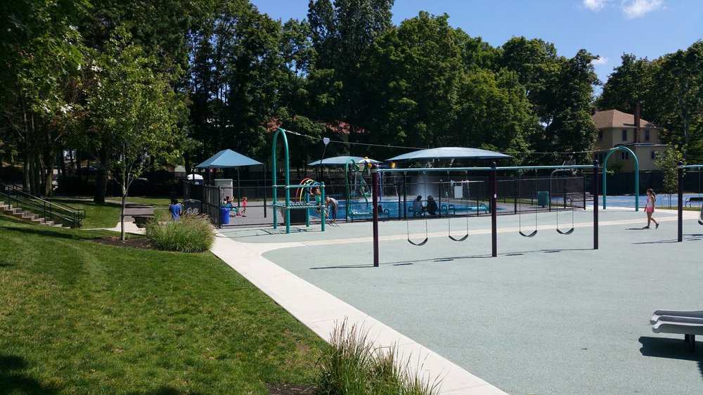
Open space is a big part of the city. Prospect Hill Park covers 273 acres with trails and overlooks of the Boston skyline, and the state's Beaver Brook Reservation and Charles River Reservation both have land in Waltham. The Western Greenway, a 12-mile footpath loop, links Waltham with Belmont and Lexington. Brandeis University and Bentley University are both in Waltham, and the campus is home to the Rose Art Museum.
To see homes for sale in Waltham, browse the listings below or contact Berkshire Hathaway HomeServices Warren Residential.
64,723 people live in Waltham, where the median age is 35.1 and the average individual income is $58,065. Data provided by the U.S. Census Bureau.
Total Population
Median Age
Population Density Population Density This is the number of people per square mile in a neighborhood.
Average individual Income
There's plenty to do around Waltham, including shopping, dining, nightlife, parks, and more. Data provided by Walk Score and Yelp.
Explore popular things to do in the area, including Tedeschi Food Shops, Cruz Market 2, and La Cava Cafe.
| Name | Category | Distance | Reviews |
Ratings by
Yelp
|
|---|---|---|---|---|
| Dining · $ | 0.63 miles | 3 reviews | 2.3/5 stars | |
| Dining | 1.1 miles | 1 review | 5/5 stars | |
| Dining | 1.13 miles | 0 reviews | 0/5 stars | |
| Shopping | 0.92 miles | 0 reviews | 0/5 stars | |
| Active | 0.43 miles | 4 reviews | 3.8/5 stars | |
| Active | 0.63 miles | 12 reviews | 4/5 stars | |
| Active | 0.9 miles | 0 reviews | 0/5 stars | |
| Active | 0.9 miles | 1 review | 5/5 stars | |
| Active | 0.94 miles | 0 reviews | 0/5 stars | |
| Active | 1.05 miles | 0 reviews | 0/5 stars | |
| Active | 1.06 miles | 0 reviews | 0/5 stars | |
| Active | 1.11 miles | 0 reviews | 0/5 stars | |
| Active | 1.2 miles | 0 reviews | 0/5 stars | |
| Active | 1.2 miles | 0 reviews | 0/5 stars | |
| Active | 1.23 miles | 0 reviews | 0/5 stars | |
| Active | 1.36 miles | 0 reviews | 0/5 stars | |
| Beauty | 0.17 miles | 0 reviews | 0/5 stars | |
| Beauty | 0.52 miles | 1 review | 5/5 stars | |
| Beauty | 0.9 miles | 0 reviews | 0/5 stars | |
| Beauty | 0.9 miles | 2 reviews | 5/5 stars | |
| Beauty | 1.03 miles | 0 reviews | 0/5 stars | |
| Beauty | 1.08 miles | 75 reviews | 4.5/5 stars | |
| Beauty | 1.16 miles | 0 reviews | 0/5 stars | |
| Beauty | 1.22 miles | 1 review | 5/5 stars | |
|
|
||||
|
|
||||
|
|
||||
|
|
||||
|
|
||||
|
|
Waltham has 25,721 households, with an average household size of 2.25. Data provided by the U.S. Census Bureau. Here’s what the people living in Waltham do for work — and how long it takes them to get there. Data provided by the U.S. Census Bureau. 64,723 people call Waltham home. The population density is 5,079 and the largest age group is Data provided by the U.S. Census Bureau.
Total Population
Population Density Population Density This is the number of people per square mile in a neighborhood.
Median Age
Men vs Women
Population by Age Group
0-9 Years
10-17 Years
18-24 Years
25-64 Years
65-74 Years
75+ Years
Education Level
Total Households
Average Household Size
Average individual Income
Households with Children
With Children:
Without Children:
Marital Status
Blue vs White Collar Workers
Blue Collar:
White Collar: