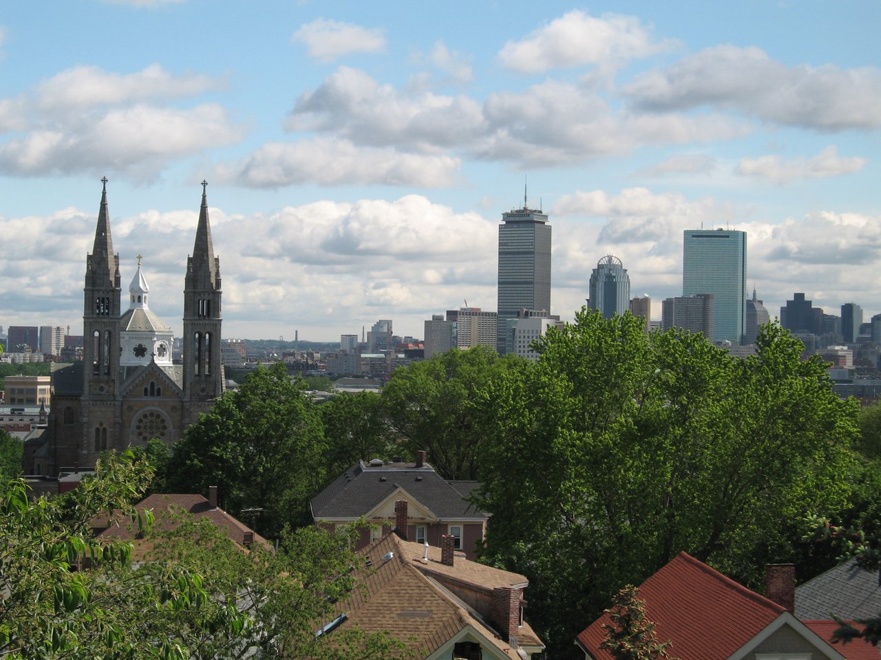
Mission Hill is a residential Boston neighborhood on the slopes of Parker Hill, set between the Longwood Medical Area, Roxbury, and Jamaica Plain, with the town of Brookline across the Riverway. Its streets of 19th-century brick rowhouses and triple-deckers climb from Huntington Avenue and Tremont Street toward the hilltop, and the twin towers of Mission Church rise above the neighborhood.
The neighborhood was part of the town of Roxbury, which was annexed to Boston in 1868, and the hill itself was long known as Parker Hill. Its current name comes from Mission Church, the Basilica of Our Lady of Perpetual Help on Tremont Street. A wooden church opened here in 1870, and the present church was dedicated in 1878. Its twin towers were completed in 1910, and the church was named a basilica in 1954. According to the Archdiocese of Boston, the church was known locally as Mission Church, and Mission Hill was named for it.
Development of the area known as the Mission Hill Triangle, between Huntington Avenue and Tremont Street, began in 1872 with rows of two-story brick houses. When Huntington Avenue was cut through in 1882, larger three-story buildings followed at the ends of Worthington and Wigglesworth Streets, along with four-story houses on Huntington Avenue itself. The neighborhood borders Fenway / Kenmore and the Longwood Medical Area to the north, Roxbury to the east, Jamaica Plain to the south, and Brookline to the west. New England Baptist Hospital stands near the top of Parker Hill, and the hospitals and colleges of Longwood are a short walk from Brigham Circle.
The Green Line E branch runs along Huntington Avenue and South Huntington Avenue, stopping at Brigham Circle, Fenwood Road, Mission Park, Riverway, and Back of the Hill before ending at Heath Street. Roxbury Crossing station on the Orange Line sits at the neighborhood's eastern edge on Tremont Street, and Ruggles station, with Orange Line and commuter rail service, is nearby. The 39 bus also runs along Huntington Avenue to Back Bay and Forest Hills.
Mission Hill's housing is mostly late 19th- and early 20th-century: brick rowhouses, triple-deckers, and two-family houses, with a number of newer condominium and apartment buildings along the main streets. Many older buildings have been converted to condominiums. The Mission Hill Triangle Architectural Conservation District, designated in 1985, protects the brick rowhouses between Huntington Avenue and Tremont Street, many faced in brownstone, sandstone, or marble and set behind small front yards. Higher on the hill, side streets wind up the slope with views toward the Fenway, the Back Bay, and downtown.
We do not yet have building pages for Mission Hill. American Brewery Lofts, condominiums in an 1891 brewery on Heath Street, sits near the Mission Hill and Jamaica Plain line and is filed under Jamaica Plain on our site.
Brigham Circle, where Tremont Street meets Huntington Avenue, is the neighborhood's commercial center, with a grocery store, pharmacies, and restaurants, and more shops and cafes line Tremont Street toward Roxbury Crossing. Kevin W. Fitzgerald Park, McLaughlin Playground, and the Parker Hill playground offer open space on the hill, and the Riverway and Olmsted Park, part of the Emerald Necklace, run along the western edge. The Museum of Fine Arts and the Gardner Museum are a short walk north.
What kinds of homes are in Mission Hill?
Housing is mostly late 19th- and early 20th-century brick rowhouses, triple-deckers and two-family houses, many converted to condominiums, with newer condominium and apartment buildings along the main streets. Higher on the hill, side streets have views toward the Fenway, the Back Bay and downtown.
How do you get around from Mission Hill?
The Green Line E branch runs along Huntington Avenue and South Huntington Avenue, stopping at Brigham Circle, Fenwood Road, Mission Park, Riverway and Back of the Hill before ending at Heath Street. Roxbury Crossing on the Orange Line is at the eastern edge, and Ruggles station adds commuter rail.
What is the Mission Hill Triangle?
The Mission Hill Triangle is the area between Huntington Avenue and Tremont Street, where development began in 1872. Its Architectural Conservation District, designated in 1985, protects brick rowhouses, many faced in brownstone, sandstone or marble and set behind small front yards.
To see homes for sale in Mission Hill, browse the listings below. Thinking of buying or selling in Mission Hill? Call (617) 848-9616 or get a free home valuation. Mission Hill is part of our Boston neighborhood guide.
Header photo: Snutter, CC BY-SA 3.0
15,802 people live in Mission Hill, where the median age is 30 and the average individual income is $38,066. Data provided by the U.S. Census Bureau.
Total Population
Median Age
Population Density Population Density This is the number of people per square mile in a neighborhood.
Average individual Income
There's plenty to do around Mission Hill, including shopping, dining, nightlife, parks, and more. Data provided by Walk Score and Yelp.
Explore popular things to do in the area, including Cadeau, Streets Boutique, and Sorenson Books.
| Name | Category | Distance | Reviews |
Ratings by
Yelp
|
|---|---|---|---|---|
| Shopping | 0.82 miles | 0 reviews | 0/5 stars | |
| Shopping | 0.92 miles | 0 reviews | 0/5 stars | |
| Shopping | 0.98 miles | 0 reviews | 0/5 stars | |
| Active | 0.38 miles | 0 reviews | 0/5 stars | |
| Active | 0.39 miles | 0 reviews | 0/5 stars | |
| Active | 0.39 miles | 0 reviews | 0/5 stars | |
| Active | 0.81 miles | 0 reviews | 0/5 stars | |
| Active | 0.86 miles | 0 reviews | 0/5 stars | |
| Active | 0.86 miles | 0 reviews | 0/5 stars | |
| Active | 0.86 miles | 0 reviews | 0/5 stars | |
| Active | 0.86 miles | 0 reviews | 0/5 stars | |
| Active | 0.88 miles | 11 reviews | 4.7/5 stars | |
| Active | 0.96 miles | 0 reviews | 0/5 stars | |
| Active | 0.97 miles | 2 reviews | 5/5 stars | |
| Active | 0.98 miles | 1 review | 1/5 stars | |
| Active | 0.98 miles | 0 reviews | 0/5 stars | |
| Active | 0.99 miles | 0 reviews | 0/5 stars | |
| Active | 0.99 miles | 0 reviews | 0/5 stars | |
| Active | 0.99 miles | 0 reviews | 0/5 stars | |
| Active | 0.99 miles | 1 review | 5/5 stars | |
| Active | 0.99 miles | 0 reviews | 0/5 stars | |
| Beauty | 0.75 miles | 3 reviews | 2.3/5 stars | |
| Beauty | 0.8 miles | 11 reviews | 2.9/5 stars | |
| Beauty | 0.88 miles | 3 reviews | 3.3/5 stars | |
|
|
||||
|
|
||||
|
|
||||
|
|
||||
|
|
||||
|
|
Mission Hill has 6,339 households, with an average household size of 2. Data provided by the U.S. Census Bureau. Here’s what the people living in Mission Hill do for work — and how long it takes them to get there. Data provided by the U.S. Census Bureau. 15,802 people call Mission Hill home. The population density is 36,505 and the largest age group is Data provided by the U.S. Census Bureau.
Total Population
Population Density Population Density This is the number of people per square mile in a neighborhood.
Median Age
Men vs Women
Population by Age Group
0-9 Years
10-17 Years
18-24 Years
25-64 Years
65-74 Years
75+ Years
Education Level
Total Households
Average Household Size
Average individual Income
Households with Children
With Children:
Without Children:
Marital Status
Blue vs White Collar Workers
Blue Collar:
White Collar: