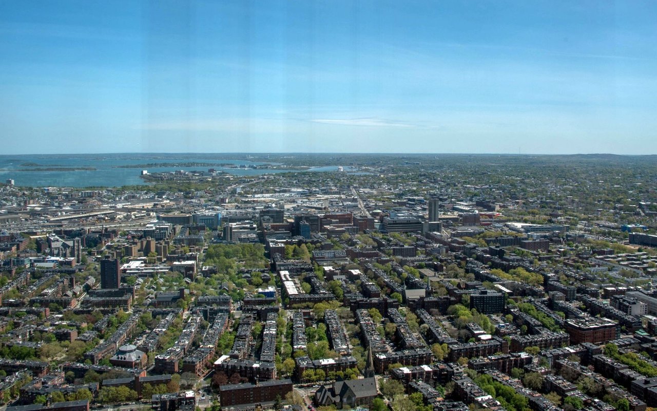
Roxbury is a historic Boston neighborhood south of the South End and east of Mission Hill and Jamaica Plain, centered on Nubian Square. Founded in 1630 as one of the first towns of the Massachusetts Bay Colony, it holds some of the oldest buildings in Boston, hilltop streets of Victorian houses, and much of Franklin Park, the largest park in the city.
Puritan settlers founded Roxbury in 1630 just south of the Shawmut Peninsula, and for nearly two centuries the town held the only land route into Boston. The First Church in Roxbury built its first meetinghouse at what is now John Eliot Square in 1632, and the present meetinghouse, dedicated in 1804, is the oldest wood-frame church in Boston. During the Siege of Boston in 1775, colonial forces built forts on the Roxbury highlands overlooking the Neck. Roxbury became a city in 1846, and its western section left in 1851 to form the town of West Roxbury. The City of Roxbury was annexed to Boston in 1868.
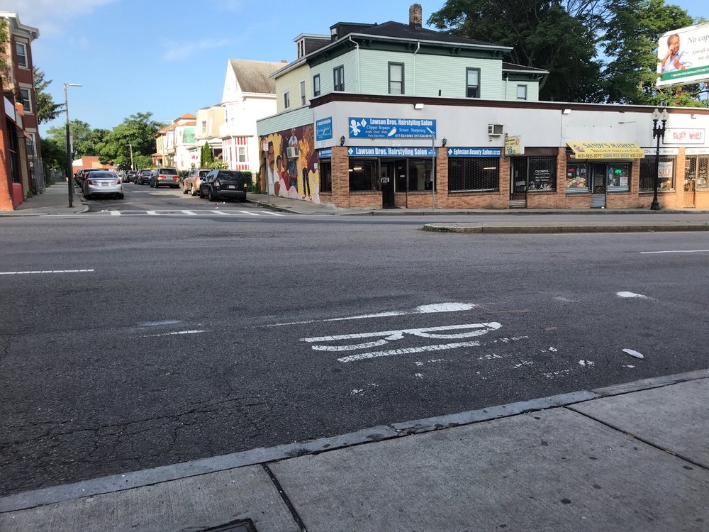
After annexation, Roxbury grew into a streetcar suburb, with brick rowhouses and commercial blocks around Dudley and Eliot Squares and elevated rail service by 1901. Dudley Square was renamed Nubian Square in 2019 to honor the area's Black heritage. Roxbury borders the South End to the north, Dorchester to the east and south, Jamaica Plain to the southwest, and Mission Hill and Fenway / Kenmore to the west.
Ruggles station serves the Orange Line and the Needham, Providence, and Franklin commuter rail lines, and Roxbury Crossing station on the Orange Line sits on the Mission Hill edge. The Silver Line SL4 and SL5 run along Washington Street from Nubian station to downtown, and Nubian is also a major bus hub. Columbus Avenue, Washington Street, Blue Hill Avenue, Warren Street, and Melnea Cass Boulevard are the main roads.
Roxbury's housing reflects a century of suburban growth. In the hilly Highland Park area, also called Fort Hill or the Roxbury Highlands, detached wood-frame houses on sloping lots mix with two-family houses, brick rowhouses, and triple-deckers built between about 1830 and 1930, in styles from Federal and Greek Revival to Italianate, Second Empire, and Queen Anne. The area is a National Register district, and in 2022 the City designated the Highland Park Architectural Conservation District to review exterior changes. Elsewhere, two- and three-unit houses and Victorian homes line the side streets off Warren Street, Blue Hill Avenue, and Washington Street, alongside newer condominium and apartment buildings near Nubian Square. We do not yet have building pages for Roxbury.
Nubian Square is the commercial center, with shops, restaurants, and civic buildings along Washington and Warren Streets. Franklin Park, designed by Frederick Law Olmsted as Boston's country park, includes the Franklin Park Zoo, a public golf course, Scarboro Pond, and miles of wooded paths. History is close at hand: the Shirley-Eustis House, built between 1747 and 1751 for Royal Governor William Shirley, is a National Historic Landmark open for tours, and the 1750 Dillaway-Thomas House on John Eliot Square, once headquarters for General John Thomas, anchors Roxbury Heritage State Park. Outcroppings of Roxbury puddingstone, named the official state rock of Massachusetts in 1983, appear throughout the neighborhood's hills.
What kinds of homes are in Roxbury?
In the hilly Highland Park area, detached wood-frame houses mix with two-family houses, brick rowhouses and triple-deckers built between about 1830 and 1930. Elsewhere, two- and three-unit houses and Victorian homes line the side streets, with newer condominium and apartment buildings near Nubian Square.
How do you get around from Roxbury?
Ruggles station serves the Orange Line and the Needham, Providence and Franklin commuter rail lines, and Roxbury Crossing station on the Orange Line sits on the Mission Hill edge. Silver Line SL4 and SL5 buses run along Washington Street from Nubian station to downtown.
What is in Franklin Park?
Franklin Park, the largest park in Boston, was designed by Frederick Law Olmsted as the city's country park. It includes the Franklin Park Zoo, a public golf course, Scarboro Pond and miles of wooded paths.
To see homes for sale in Roxbury, browse the listings below. Thinking of buying or selling in Roxbury? Call (617) 848-9616 or get a free home valuation. Roxbury is part of our Boston neighborhood guide.
26,851 people live in Roxbury, where the median age is 35.3 and the average individual income is $32,553. Data provided by the U.S. Census Bureau.
Total Population
Median Age
Population Density Population Density This is the number of people per square mile in a neighborhood.
Average individual Income
There's plenty to do around Roxbury, including shopping, dining, nightlife, parks, and more. Data provided by Walk Score and Yelp.
Explore popular things to do in the area, including Chili Dog Grill & Chicken, Erfan’s Market, and Simons Liquor Store.
| Name | Category | Distance | Reviews |
Ratings by
Yelp
|
|---|---|---|---|---|
| Dining | 0.38 miles | 0 reviews | 0/5 stars | |
| Dining | 0.38 miles | 0 reviews | 0/5 stars | |
| Dining | 0.53 miles | 1 review | 5/5 stars | |
| Dining | 0.67 miles | 0 reviews | 0/5 stars | |
| Shopping | 0.4 miles | 0 reviews | 0/5 stars | |
| Beauty | 0.02 miles | 0 reviews | 0/5 stars | |
| Beauty | 0.34 miles | 0 reviews | 0/5 stars | |
| Beauty | 0.9 miles | 1 review | 5/5 stars | |
| Beauty | 0.94 miles | 28 reviews | 1.9/5 stars | |
| Beauty | 0.97 miles | 0 reviews | 0/5 stars | |
|
|
||||
|
|
||||
|
|
||||
|
|
||||
|
|
||||
|
|
Roxbury has 11,764 households, with an average household size of 2.23. Data provided by the U.S. Census Bureau. Here’s what the people living in Roxbury do for work — and how long it takes them to get there. Data provided by the U.S. Census Bureau. 26,851 people call Roxbury home. The population density is 16,624 and the largest age group is Data provided by the U.S. Census Bureau.
Total Population
Population Density Population Density This is the number of people per square mile in a neighborhood.
Median Age
Men vs Women
Population by Age Group
0-9 Years
10-17 Years
18-24 Years
25-64 Years
65-74 Years
75+ Years
Education Level
Total Households
Average Household Size
Average individual Income
Households with Children
With Children:
Without Children:
Marital Status
Blue vs White Collar Workers
Blue Collar:
White Collar: