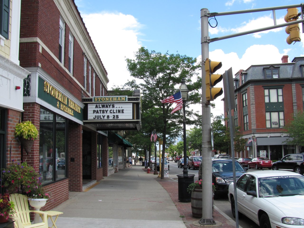
Stoneham is a town in Middlesex County less than 10 miles northwest of Boston, and about a third of its land lies within the Middlesex Fells Reservation. It combines a Main Street business center, streets of 19th-century houses, and the woods and water of Spot Pond, with Stone Zoo at the edge of the Fells.
The area was part of the Charlestown grant and was known as Charlestown End when farmers settled it in the 1600s. Its residents petitioned to form their own town, and the General Court granted the request on December 17, 1725. The Medford and Andover Turnpike, opened in 1806, pulled the town center to Main Street, and a railroad branch from Woburn arrived in 1862. Shoemaking grew from home workshops into factories, most of them built along Main Street between 1850 and 1880, and the town seal still recalls its shoe, tannery, and box-making past.
Spot Pond powered the rubber works at Haywardville in the mid-1800s, and the land around it later became part of the Middlesex Fells Reservation and a reservoir for the metropolitan water system. Stoneham borders Reading to the north, Wakefield to the east, Melrose to the southeast, Malden and Medford to the south, Winchester to the southwest, and Woburn to the west.
Stoneham has no rail station of its own. MBTA bus route 132 runs from the Redstone Shopping Center through the town to Malden Center, with Orange Line service, and route 99 links Stoneham with Wellington station. Commuter rail stations are close by in Melrose, Wakefield, and Winchester, and Oak Grove station, the northern end of the Orange Line, is in Malden. Interstate 93 passes through town, and Interstate 95/Route 128 runs just to the north.
Stoneham real estate is mostly single-family frame houses, a pattern set in the 1800s. Greek Revival cottages stand east of Main Street, porticoed Greek Revival houses line parts of Main Street, and Italianate cottages went up near the shoe factories for their workers. Larger Italianate and mansard-roofed villas stand on Maple, Warren, and Chestnut streets, and two octagon houses survive on Spring and Pine streets.
The late 1800s added Second Empire, Stick, and Queen Anne houses, and Craftsman houses and Colonial Revival bungalows followed between the world wars. Historic areas include Farm Hill, Doleful Plain along Marble and Summer streets, Haywardville on Spot Pond Brook, and the Wright Street area southwest of the business district.
The Middlesex Fells Reservation has more than 100 miles of trails for hiking, mountain biking, and horseback riding, and canoes and kayaks can be rented on Spot Pond. Bear Hill is the most prominent peak in the town's part of the Fells. Stone Zoo, run by Zoo New England on Pond Street, is home to snow leopards, jaguars, river otters, Mexican gray wolves, and other animals.
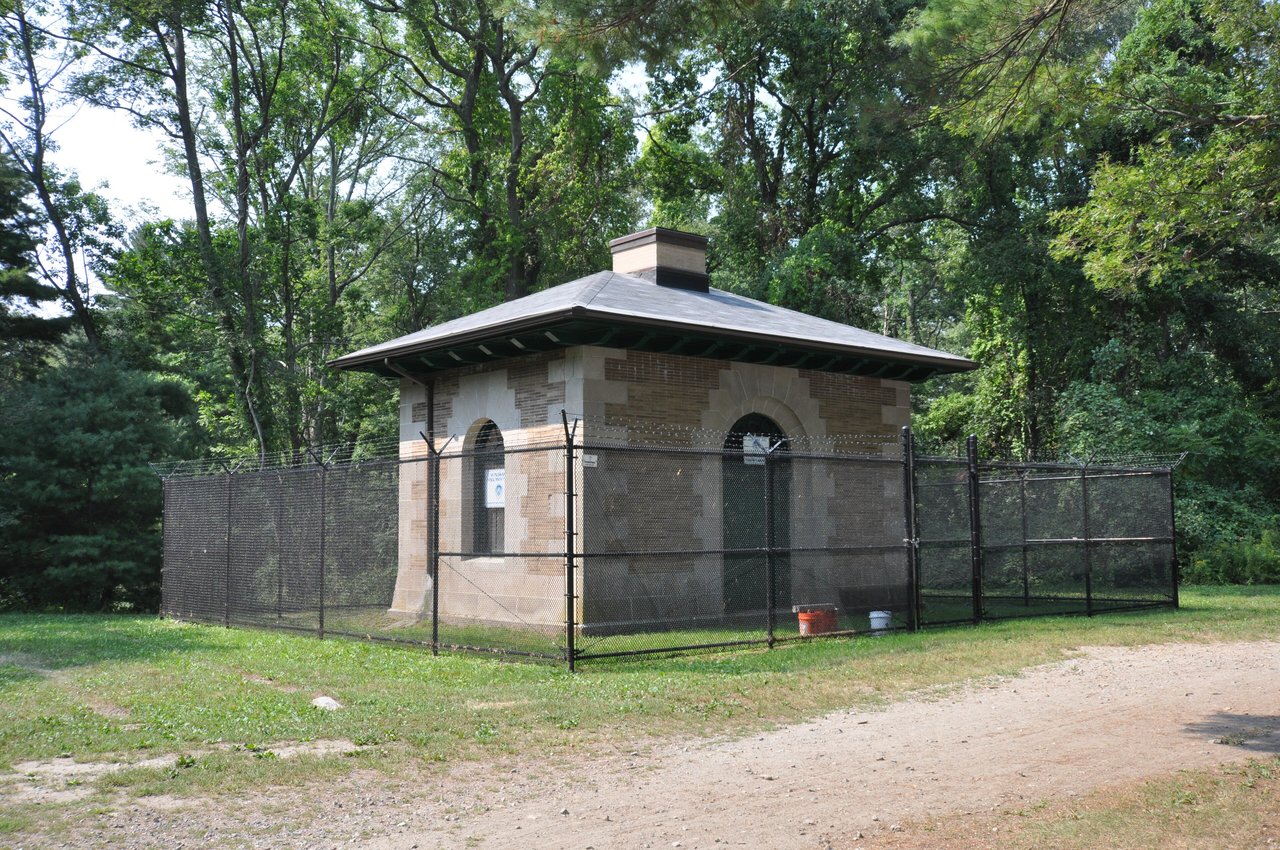
Central Square, where Main, Franklin, and Central streets meet, has long been the town's commercial core, near the 1840 First Congregational Church. On the shore of Spot Pond, the 1900 pumping station designed by Shepley, Rutan and Coolidge still stands, and the Sanborn and Mann shoe factory at 426 Main Street recalls the town's industrial era.
What kinds of homes are in Stoneham?
Stoneham is mostly single-family frame houses, from Greek Revival and Italianate cottages to Second Empire, Stick, and Queen Anne homes of the late 1800s. Craftsman houses and Colonial Revival bungalows followed between the world wars.
How do you get to Boston from Stoneham?
MBTA bus route 132 runs through Stoneham to Malden Center for the Orange Line, and Oak Grove station is nearby in Malden. Commuter rail stations are close by in Melrose, Wakefield, and Winchester, and Interstate 93 runs through town toward Boston.
How much of Stoneham is in the Middlesex Fells?
About one-third of Stoneham lies within the Middlesex Fells Reservation, including Spot Pond. The reservation has more than 100 miles of trails and canoe and kayak rentals on Spot Pond, and Stone Zoo sits at its edge on Pond Street.
To see homes for sale in Stoneham, browse the listings below. Thinking of buying or selling in Stoneham? Call (617) 848-9616 or get a free home valuation. Stoneham is part of our North of Boston guide.
Photos: John Phelan, CC BY 3.0 and Magicpiano, CC BY-SA 4.0, via Wikimedia Commons.
23,355 people live in Stoneham, where the median age is 42.2 and the average individual income is $62,866. Data provided by the U.S. Census Bureau.
Total Population
Median Age
Population Density Population Density This is the number of people per square mile in a neighborhood.
Average individual Income
There's plenty to do around Stoneham, including shopping, dining, nightlife, parks, and more. Data provided by Walk Score and Yelp.
Explore popular things to do in the area, including Grazy, Circle K, and Dairy Mart Convenience Store.
| Name | Category | Distance | Reviews |
Ratings by
Yelp
|
|---|---|---|---|---|
| Dining | 0.34 miles | 1 review | 5/5 stars | |
| Dining | 0.58 miles | 0 reviews | 0/5 stars | |
| Dining | 1.74 miles | 0 reviews | 0/5 stars | |
| Shopping | 0.4 miles | 0 reviews | 0/5 stars | |
| Active | 0.84 miles | 0 reviews | 0/5 stars | |
| Active | 0.85 miles | 0 reviews | 0/5 stars | |
| Active | 1.54 miles | 0 reviews | 0/5 stars | |
| Active | 1.54 miles | 0 reviews | 0/5 stars | |
| Active | 1.54 miles | 0 reviews | 0/5 stars | |
| Active | 1.75 miles | 0 reviews | 0/5 stars | |
| Active | 1.75 miles | 0 reviews | 0/5 stars | |
| Active | 1.75 miles | 0 reviews | 0/5 stars | |
| Beauty | 0.28 miles | 6 reviews | 3.2/5 stars | |
| Beauty | 0.72 miles | 0 reviews | 0/5 stars | |
| Beauty | 0.79 miles | 1 review | 4/5 stars | |
| Beauty | 1.35 miles | 26 reviews | 3.1/5 stars | |
| Beauty | 1.42 miles | 6 reviews | 5/5 stars | |
| Beauty | 1.44 miles | 0 reviews | 0/5 stars | |
| Beauty | 1.53 miles | 0 reviews | 0/5 stars | |
|
|
||||
|
|
||||
|
|
||||
|
|
||||
|
|
||||
|
|
Stoneham has 9,749 households, with an average household size of 2.39. Data provided by the U.S. Census Bureau. Here’s what the people living in Stoneham do for work — and how long it takes them to get there. Data provided by the U.S. Census Bureau. 23,355 people call Stoneham home. The population density is 3,882 and the largest age group is Data provided by the U.S. Census Bureau.
Total Population
Population Density Population Density This is the number of people per square mile in a neighborhood.
Median Age
Men vs Women
Population by Age Group
0-9 Years
10-17 Years
18-24 Years
25-64 Years
65-74 Years
75+ Years
Education Level
Total Households
Average Household Size
Average individual Income
Households with Children
With Children:
Without Children:
Marital Status
Blue vs White Collar Workers
Blue Collar:
White Collar: